U.S. Geological Survey Open-File Report 2010–1007
Sea-Floor Geology and Character Offshore of Rocky Point, New York
 |
||
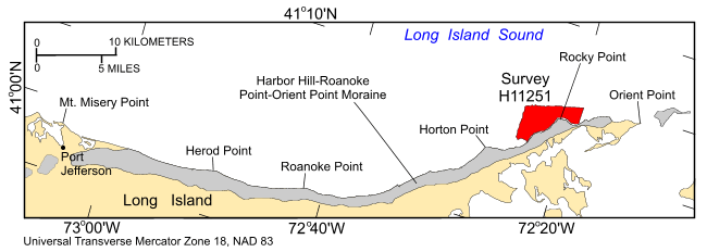
Figure 2. Locations of prominent points along the north shore of Long Island east of Port Jefferson, the Harbor Hill-Roanoke Point-Orient Point Moraine, and National Oceanic and Atmospheric Administration survey H11251. | ||

![]() U.S. Department of the Interior |
U.S. Geological Survey
U.S. Department of the Interior |
U.S. Geological Survey
URL: https://pubsdata.usgs.gov/pubs/of/2010/1007/html/fig2.html
Page Contact Information: Contact USGS
Page Last Modified: Wednesday, 07-Dec-2016 22:38:10 EST


