U.S. Geological Survey Open-File Report 2010–1007
Sea-Floor Geology and Character Offshore of Rocky Point, New York
 |
||
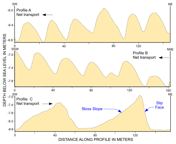
Figure 22. Cross-sectional views of sand waves around Orient Shoal from the digital terrain model produced during National Oceanic and Atmospheric Administration survey H11251 off Rocky Point, New York. Sand-wave asymmetry in profiles A and B indicate net sediment transport is westward along the southern side of the shoal and eastward along the northwestward side in profile C. Locations of profiles are shown in figure 16. | ||

![]() U.S. Department of the Interior |
U.S. Geological Survey
U.S. Department of the Interior |
U.S. Geological Survey
URL: https://pubsdata.usgs.gov/pubs/of/2010/1007/html/fig22.html
Page Contact Information: Contact USGS
Page Last Modified: Wednesday, 07-Dec-2016 22:38:12 EST


