U.S. Geological Survey Open-File Report 2010–1007
Sea-Floor Geology and Character Offshore of Rocky Point, New York
 |
||
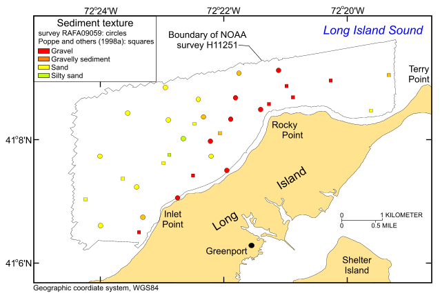
Figure 27. Station locations used to verify the acoustic data, color-coded for sediment texture. Warmer colors are coarser grained sediments; cooler colors are finer grained sediments. See key for sediment classifications and data sources. | ||

![]() U.S. Department of the Interior |
U.S. Geological Survey
U.S. Department of the Interior |
U.S. Geological Survey
URL: https://pubsdata.usgs.gov/pubs/of/2010/1007/html/fig27.html
Page Contact Information: Contact USGS
Page Last Modified: Wednesday, 07-Dec-2016 22:38:15 EST


