Skip past header information
USGS - science for a changing world

U.S. Geological Survey Open-File Report 2010-1035

Geophysical Data Collected from the St. Clair River between Michigan and Ontario, Canada (2008-016-FA)


Skip past contents informationTitle Page / Contents / List of Figures / Conversion Factors / Abstract / Introduction / Data Acquisition and Processing / Data Catalog / Acknowledgments / References Cited


Figure 1, location map showing the St. Clair River and the USGS study area.

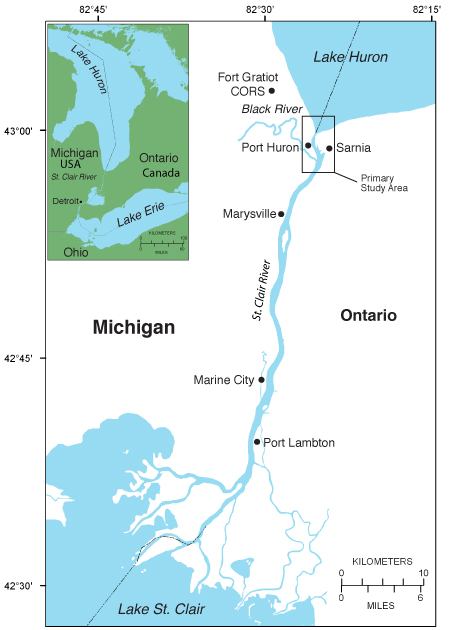
Figure 1. Map showing the St. Clair River. The primary study area lies in the northern reaches of the river, with two additional study sites offshore from Marysville, Mich., and Port Lambton, Ontario. Base map generated from data supplied by ESRI, ArcGIS 9.2. After Foster and Denny, 2009.

Download the full size image in PDF format (750 KB).


To view files in PDF format, download a free copy of Adobe Reader.


Skip USGS links group

Accessibility FOIA Privacy Policies and Notices

Take Pride in America logo USAGov logo U.S. Department of the Interior | U.S. Geological Survey
End of USGS links group