U.S. Geological Survey Open-File Report 2010-1035
Geophysical Data Collected from the St. Clair River between Michigan and Ontario, Canada (2008-016-FA)
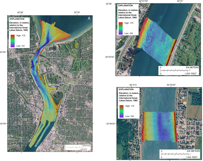 |
Figure 6. Color-shaded relief images of the bathymetry collected by the USGS in the St. Clair River. All depths are relative to the International Great Lakes Datum, 1985. (A) Northernmost St. Clair River area. Depths range from approximately 151 to 175 meters. (B) At Marysville, MI, depths range from approximately 164 to 175 meters. (C) At Port Lambton, Ontario, depths range from approximately 159 to 174 meters. 2005 orthophoto base from Michigan State University, Remote Sensing & GIS Research and Outreach Services, USDA-FSA Aerial Photography Field Office.
|


