U.S. Geological Survey Open-File Report 2010-1035
Geophysical Data Collected from the St. Clair River between Michigan and Ontario, Canada (2008-016-FA)
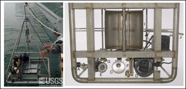 |
Figure 8. The U.S. Geological Survey Mini SEABOSS, shown (left) being deployed from the RV Rafael was used to collect sediment samples, and to take video and digital photographs. The Mini SEABOSS components viewed from below (right) are: (A) forward video camera; (B) downward video camera; (C) video light; (D) digital still camera and housing; (E) strobe light; (F) parallel lasers for scale; (G) laser for ranging; (H) junction block; (I) Van Veen grab sampler; (J) multiconducting cable. (Photographs by D. Blackwood, U.S. Geological Survey).
|


