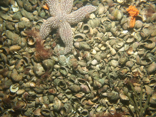
Skip past header information
USGS - science for a changing world

U.S. Geological Survey Open-File Report 2010-1091

High-Resolution Geophysical Data Collected Within Red Brook Harbor, Buzzards Bay, Massachusetts, in 2009


Skip past contents information/ Title Page / Acknowledgments / List of Figures / Conversion Factors / Abstract / Introduction / Data Acquisition and Processing / Data Description / References Cited / Appendix 1 /


Figure 13:  Photograph showing dense Atlantic slippersnail shell cover which is present in much of the outer portion Red Brook Harbor. The photograph was acquired with the USGS MiniSEABOSS.


Figure 13. Photograph showing dense Atlantic slippersnail shell cover which is present in much of the outer portion of Red Brook Harbor, Massachussets.  The photograph was acquired with the U.S. Geological Survey Mini SEABOSS (Mini SEABed Observation and Sampling System). 


Download the full size image in PDF format.


To view files in PDF format, download a free copy of Adobe Reader.


Skip USGS links group

Accessibility FOIA Privacy Policies and Notices

Take Pride in America logo USAGov logo U.S. Department of the Interior | U.S. Geological Survey
End of USGS links group