Skip past header information
USGS - science for a changing world

U.S. Geological Survey Open-File Report 2010-1178

Geophysical Data from offshore of the Gulf Islands National Seashore, Cat Island to Western Horn Island, Mississippi


Skip past navigation menu to main textTitle Page / Contents / List of Figures / Conversion Factors and Datum / Abstract / Introduction / Data Acquisition and Processing / Data Catalog / Acknowledgments / References Cited


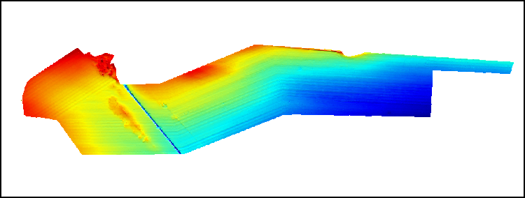
Bathy_grd: Image of the bathymetric grid as stored within ArcMap™ 9.3 map document.


To view files in PDF format, download a free copy of Adobe Reader.

Skip USGS links group

Accessibility FOIA Privacy Policies and Notices

Take Pride in America logo USAGov logo U.S. Department of the Interior | U.S. Geological Survey
End of USGS links group