Skip past header information
USGS - science for a changing world

U.S. Geological Survey Open-File Report 2010-1178

Geophysical Data from offshore of the Gulf Islands National Seashore, Cat Island to Western Horn Island, Mississippi


Skip past navigation menu to main textTitle Page / Contents / List of Figures / Conversion Factors and Datum / Abstract / Introduction / Data Acquisition and Processing / Data Catalog / Acknowledgments / References Cited


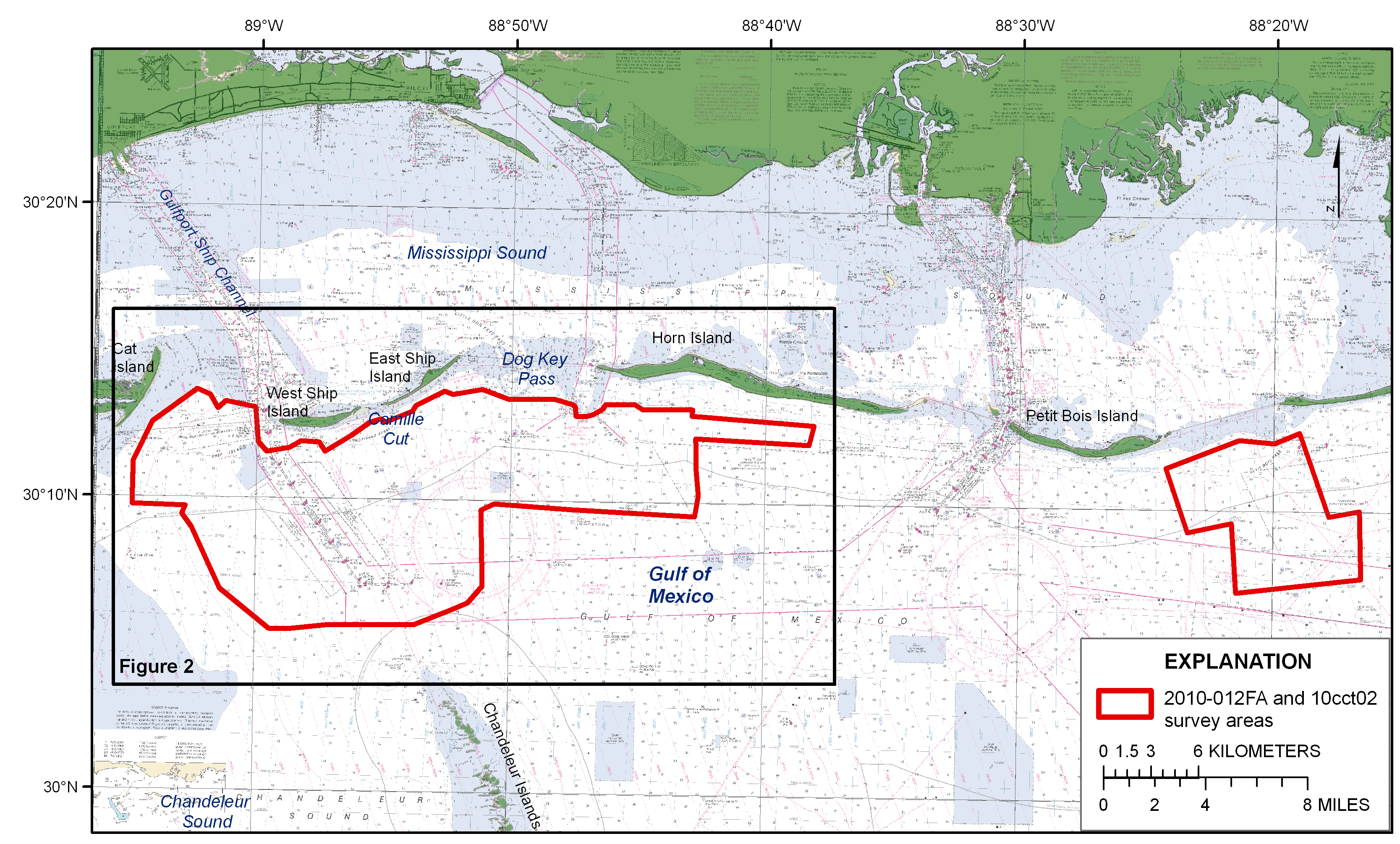
Figure 1. Location map of the Mississippi Gulf Islands survey areas for cruise IDs 2010-012-FA and 10CCT02. The red polygons outline two survey areas. The black box indicates the survey area that is the focus of this report. Figure 2 contains a more detailed view of this survey area.

Figure 1 is a location map of the Mississippi Gulf Islands survey areas for cruise IDs 2010-012FA and 10CCT02. The black box is indicating the survey area (in red) that is the focus of this report.

Skip USGS links group

Accessibility FOIA Privacy Policies and Notices

Take Pride in America logo USAGov logo U.S. Department of the Interior | U.S. Geological Survey
End of USGS links group