U.S. Geological Survey Open-File Report 2011-1015
Quaternary Geophysical Framework of the Northeastern North Carolina Coastal System
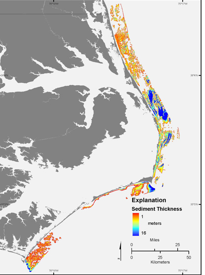 |
Figure 10. Map showing the thickness of modern sand on the inner continental shelf.
|

![]() U.S. Department of the Interior |
U.S. Geological Survey
U.S. Department of the Interior |
U.S. Geological Survey
URL: http://pubsdata.usgs.gov/pubs/of/2011/1015/figure10.html
Page Contact Information: GS Pubs Web Contact
Page Last Modified: Thursday, 08-Dec-2016 00:29:34 EST
