U.S. Geological Survey Open-File Report 2011-1015
Quaternary Geophysical Framework of the Northeastern North Carolina Coastal System
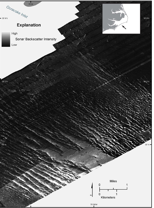 |
Figure 12. Map showing a region of sorted bedforms (Murray and Thieler, 2004) on the inner continental shelf off Ocracoke Inlet, between Cape Hatteras and Cape Lookout, as imaged by sidescan sonar. Coarse sediments are imaged as high acoustic backscatter (light gray to white); fine sediments are imaged as low acoustic backscatter (dark gray to black).
|

![]() U.S. Department of the Interior |
U.S. Geological Survey
U.S. Department of the Interior |
U.S. Geological Survey
URL: http://pubsdata.usgs.gov/pubs/of/2011/1015/figure12.html
Page Contact Information: GS Pubs Web Contact
Page Last Modified: Thursday, 08-Dec-2016 00:29:36 EST
