U.S. Geological Survey Open-File Report 2011-1015
Quaternary Geophysical Framework of the Northeastern North Carolina Coastal System
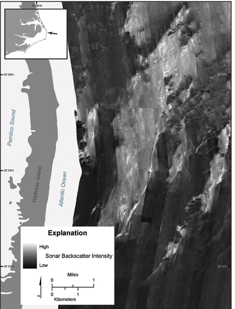 |
Figure 9. Map showing a region of coarse sediment (light gray to white) on the inner continental shelf off Hatteras Island. This region is nearly devoid of modern sediment and thus indicates exposure of Pleistocene deposits.
|

![]() U.S. Department of the Interior |
U.S. Geological Survey
U.S. Department of the Interior |
U.S. Geological Survey
URL: http://pubsdata.usgs.gov/pubs/of/2011/1015/figure9.html
Page Contact Information: GS Pubs Web Contact
Page Last Modified: Thursday, 08-Dec-2016 00:29:45 EST
