U.S. Geological Survey Open-File Report 2011–1149
Sea-Floor Geology of Long Island Sound North of Duck Pond Point, New York
![]() Title |
List of Figures |
Conversion Factors |
Abstract |
Introduction |
Setting |
Methods |
Bathymetry |
Sediments |
Bottom Photography |
GIS Data Catalog |
Summary |
Acknowledgments |
References |
Contacts
Title |
List of Figures |
Conversion Factors |
Abstract |
Introduction |
Setting |
Methods |
Bathymetry |
Sediments |
Bottom Photography |
GIS Data Catalog |
Summary |
Acknowledgments |
References |
Contacts
 |
||
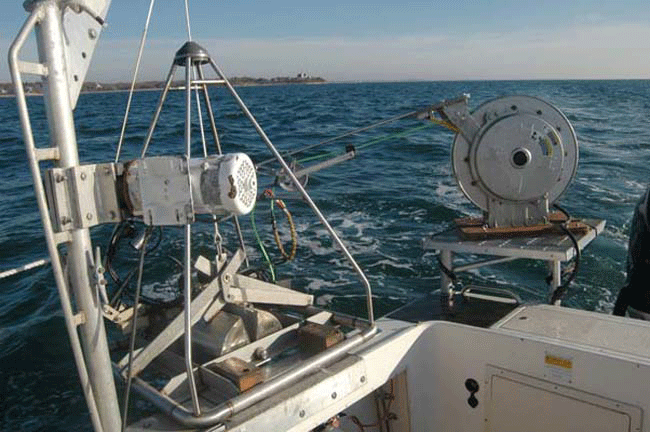
Figure 11. Photograph showing the small SEABed Observation and Sampling System (SEABOSS), a modified Van Veen grab sampler equipped with still and video photographic systems, mounted on the aft starboard side of the U.S. Geological Survey (USGS) research vessel Rafael. The system uses a winch, mounted on a davit (left), and a take-up reel for the video-signal and power cable (right). The small SEABOSS was used on USGS cruise 2010-010-FA; a larger version of this device, the mid-sized SEABOSS was used on USGS cruise 2010-015-FA. |
||


