U.S. Geological Survey Open-File Report 2011–1149
Sea-Floor Geology of Long Island Sound North of Duck Pond Point, New York
![]() Title |
List of Figures |
Conversion Factors |
Abstract |
Introduction |
Setting |
Methods |
Bathymetry |
Sediments |
Bottom Photography |
GIS Data Catalog |
Summary |
Acknowledgments |
References |
Contacts
Title |
List of Figures |
Conversion Factors |
Abstract |
Introduction |
Setting |
Methods |
Bathymetry |
Sediments |
Bottom Photography |
GIS Data Catalog |
Summary |
Acknowledgments |
References |
Contacts
 |
||
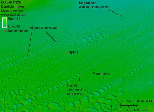
Figure 18. Detailed multibeam bathymetry image showing lines of sand waves that are mostly barchanoid sand waves in the southwest, which grade into sinusoidal-crested megaripples in the northeast. Location of image shown in figure 16. |
||


