U.S. Geological Survey Open-File Report 2011–1149
Sea-Floor Geology of Long Island Sound North of Duck Pond Point, New York
![]() Title |
List of Figures |
Conversion Factors |
Abstract |
Introduction |
Setting |
Methods |
Bathymetry |
Sediments |
Bottom Photography |
GIS Data Catalog |
Summary |
Acknowledgments |
References |
Contacts
Title |
List of Figures |
Conversion Factors |
Abstract |
Introduction |
Setting |
Methods |
Bathymetry |
Sediments |
Bottom Photography |
GIS Data Catalog |
Summary |
Acknowledgments |
References |
Contacts
 |
||
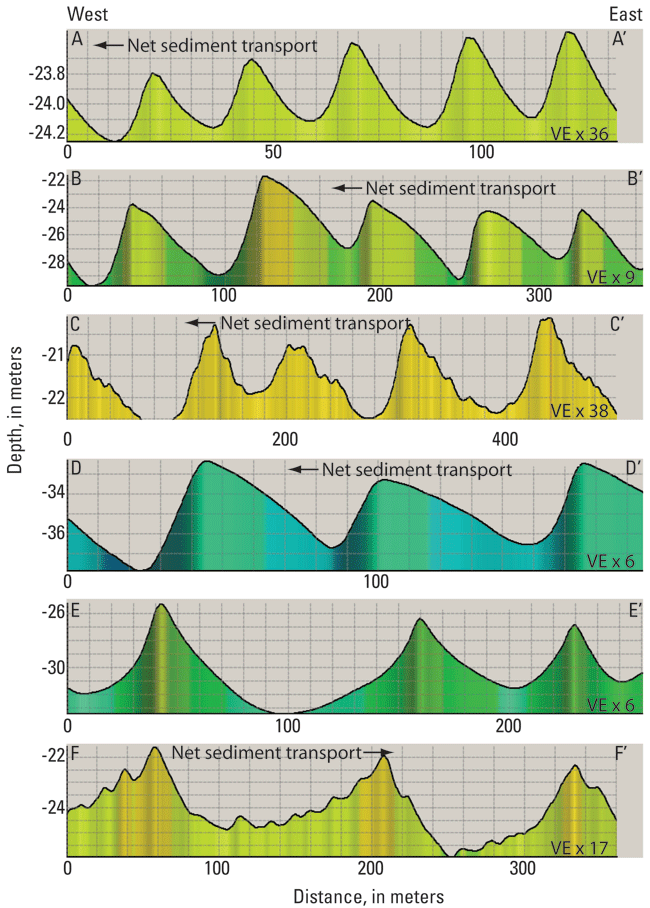
Figure 20. Charts showing profiles of sand waves in the study area. A-A' through D-D' show sand waves with asymmetries that indicate net sediment transport to the west. E-E' shows relatively symmetrical sand waves that suggest no dominant sediment transport direction. F-F' shows asymmetrical sand waves indicative of eastward net sediment transport. VE, vertical exaggeration. Location of profiles shown in figure 16. |
||


