U.S. Geological Survey Open-File Report 2011–1149
Sea-Floor Geology of Long Island Sound North of Duck Pond Point, New York
![]() Title |
List of Figures |
Conversion Factors |
Abstract |
Introduction |
Setting |
Methods |
Bathymetry |
Sediments |
Bottom Photography |
GIS Data Catalog |
Summary |
Acknowledgments |
References |
Contacts
Title |
List of Figures |
Conversion Factors |
Abstract |
Introduction |
Setting |
Methods |
Bathymetry |
Sediments |
Bottom Photography |
GIS Data Catalog |
Summary |
Acknowledgments |
References |
Contacts
 |
||
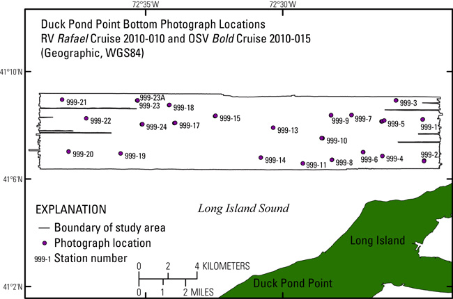
Figure 27. Map showing location of bottom photographs taken during U.S. Geological Survey research vessel (RV) Rafael cruise 2010-010 and U.S. Environmental Protection Agency ocean survey vessel (OSV) Bold cruise 2010-015 north of Duck Pond Point, New York. WGS84, World Geodetic System 1984. |
||


