U.S. Geological Survey Open-File Report 2012–1005
Sea-Floor Character and Sedimentary Processes of Block Island Sound, Offshore Rhode Island
 |
||
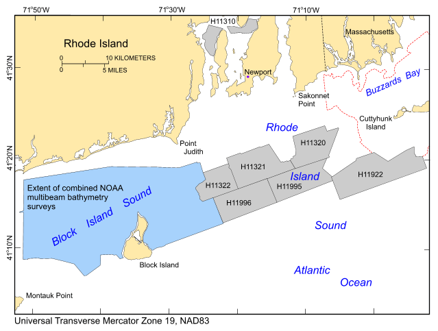
Figure 1. Location of the combined multibeam echosounder dataset for Block Island Sound, offshore Rhode Island, released in this report (blue polygon). Also shown are the extent of the data collected by the Massachusetts Mapping Cooperative (dashed red line; Barnhardt and Andrews, 2006; Ackerman and others, 2012) and the locations of other surveys by the National Oceanic and Atmospheric Administration Ships Thomas Jefferson and Rude off Rhode Island for which digital reports containing geological interpretations have been completed (light gray polygons). These surveys and their respective reports include: H11310—McMullen and others (2007a); H11320—McMullen and others (2007b); H11321—McMullen and others (2008); H11322—McMullen and others (2009a); H11996—McMullen and others (2011); H11922—Poppe and others (2011); and H11995—McMullen and others (2012). |
||

![]() U.S. Department of the Interior |
U.S. Geological Survey
U.S. Department of the Interior |
U.S. Geological Survey
URL: http://pubsdata.usgs.gov/pubs/of/2012/1005/html/fig1.html
Page Contact Information: GS Pubs Web Contact
Page Last Modified: Tuesday, 22-Jul-2014 09:33:09 EDT

