U.S. Geological Survey Open-File Report 2012–1005
Sea-Floor Character and Sedimentary Processes of Block Island Sound, Offshore Rhode Island
 |
||
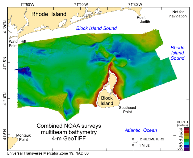
Figure 17. Digital terrain model (DTM) of the sea floor produced from the combined multibeam bathymetry collected during National Oceanic and Atmospheric Administration surveys H12009, H12010, H12011, H12015, H12033, H12137, and H12139 in Block Island Sound, offshore Rhode Island. Image is sun-illuminated from the north and vertically exaggerated 5x. Warmer colors are shallower areas; cooler colors are deeper areas. See key for depth ranges. |
||

![]() U.S. Department of the Interior |
U.S. Geological Survey
U.S. Department of the Interior |
U.S. Geological Survey
URL: http://pubsdata.usgs.gov/pubs/of/2012/1005/html/fig17.html
Page Contact Information: GS Pubs Web Contact
Page Last Modified: Tuesday, 22-Jul-2014 09:38:01 EDT

