U.S. Geological Survey Open-File Report 2012–1005
Sea-Floor Character and Sedimentary Processes of Block Island Sound, Offshore Rhode Island
 |
||
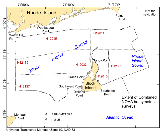
Figure 2. Map showing extents of the individual National Oceanic and Atmospheric Administration hydrographic surveys used to create the combined multibeam echosounder dataset for Block Island Sound released in this report. These surveys include H12009, H12010, H12011, H12015, H12033, H12137, and H12139. Also shown are prominent local physiographic features. |
||

![]() U.S. Department of the Interior |
U.S. Geological Survey
U.S. Department of the Interior |
U.S. Geological Survey
URL: http://pubsdata.usgs.gov/pubs/of/2012/1005/html/fig2.html
Page Contact Information: GS Pubs Web Contact
Page Last Modified: Tuesday, 22-Jul-2014 09:33:08 EDT

