U.S. Geological Survey Open-File Report 2012–1005
Sea-Floor Character and Sedimentary Processes of Block Island Sound, Offshore Rhode Island
 |
||
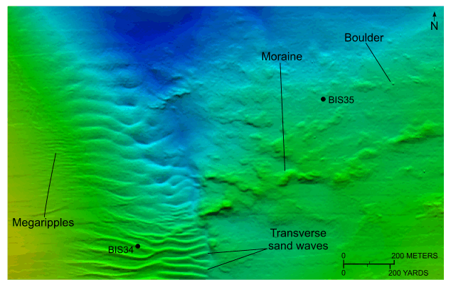
Figure 21. Detailed planar view of the combined National Oceanic and Atmospheric Administration surveys in Block Island Sound showing a submerged section of the Ronkonkoma-Nantucket end moraine, adjacent sand waves, and the locations of stations BIS34 and BIS35. Note that sand wave asymmetry, where present, indicates net northward sediment transport in this area. Location of view is shown in figure 18. |
||