U.S. Geological Survey Open-File Report 2012–1005
Sea-Floor Character and Sedimentary Processes of Block Island Sound, Offshore Rhode Island
 |
||
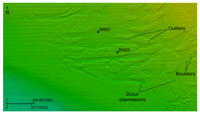
Figure 24. Detailed planar view of the combined National Oceanic and Atmospheric Administration surveys in Block Island Sound showing storm-wave induced scour on the flanks of the bathymetric high southeast of Point Judith and the locations of stations BIS62 and BIS63. Note the relatively flat, featureless appearance of the surrounding seabed composed of Holocene marine sediments, the boulders on the floor of the depressions, and the presence of outliers. Location of view is shown in figure 18. |
||

![]() U.S. Department of the Interior |
U.S. Geological Survey
U.S. Department of the Interior |
U.S. Geological Survey
URL: http://pubsdata.usgs.gov/pubs/of/2012/1005/html/fig24.html
Page Contact Information: GS Pubs Web Contact
Page Last Modified: Tuesday, 22-Jul-2014 11:16:17 EDT

