U.S. Geological Survey Open-File Report 2012–1005
Sea-Floor Character and Sedimentary Processes of Block Island Sound, Offshore Rhode Island
 |
||
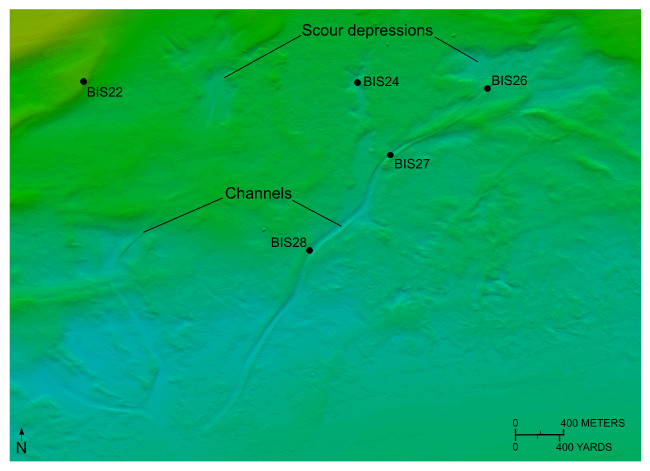
Figure 27. Detailed planar view of the combined National Oceanic and Atmospheric Administration surveys in Block Island Sound showing channels in the western part of the study area and locations of stations BIS22, BIS24, BIS26, BIS27, and BIS28. Note that the channels start in storm-wave induced scour depressions and that the channels merge down slope. Location of view is shown in figure 18. |
||

![]() U.S. Department of the Interior |
U.S. Geological Survey
U.S. Department of the Interior |
U.S. Geological Survey
URL: http://pubsdata.usgs.gov/pubs/of/2012/1005/html/fig27.html
Page Contact Information: GS Pubs Web Contact
Page Last Modified: Tuesday, 22-Jul-2014 11:16:16 EDT

