U.S. Geological Survey Open-File Report 2012–1005
Sea-Floor Character and Sedimentary Processes of Block Island Sound, Offshore Rhode Island
 |
||
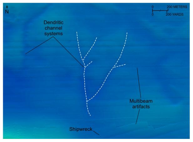
Figure 28. Detailed planar view of the combined National Oceanic and Atmospheric Administration surveys in Block Island Sound showing channels in the eastern part of the study area and location of a shipwreck. Note that the channels form dendritic patterns and that the axes of one channel system are shown by white dashed lines. Location of view is shown in figure 18. |
||

![]() U.S. Department of the Interior |
U.S. Geological Survey
U.S. Department of the Interior |
U.S. Geological Survey
URL: http://pubsdata.usgs.gov/pubs/of/2012/1005/html/fig28.html
Page Contact Information: GS Pubs Web Contact
Page Last Modified: Tuesday, 22-Jul-2014 11:16:15 EDT

