U.S. Geological Survey Open-File Report 2012–1005
Sea-Floor Character and Sedimentary Processes of Block Island Sound, Offshore Rhode Island
 |
||
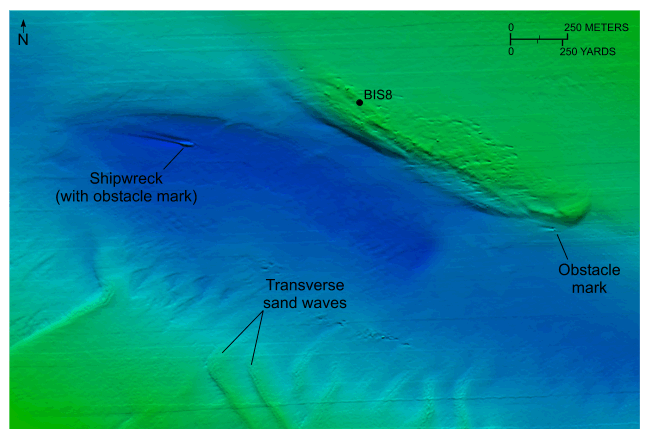
Figure 30. Detailed planar view of the combined National Oceanic and Atmospheric Administration surveys in Block Island Sound showing a scour depression formed by tidal scour in the southwestern part of the study area and location of station BIS8. Note that sand-wave and obstacle-mark asymmetry indicate northwestward net sediment transport. Location of view is shown in figure 18. |
||

![]() U.S. Department of the Interior |
U.S. Geological Survey
U.S. Department of the Interior |
U.S. Geological Survey
URL: http://pubsdata.usgs.gov/pubs/of/2012/1005/html/fig30.html
Page Contact Information: GS Pubs Web Contact
Page Last Modified: Tuesday, 22-Jul-2014 11:16:14 EDT

