U.S. Geological Survey Open-File Report 2012–1005
Sea-Floor Character and Sedimentary Processes of Block Island Sound, Offshore Rhode Island
 |
||
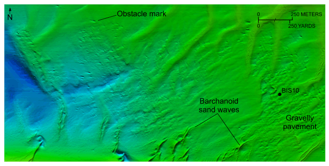
Figure 32. Detailed planar view of the combined National Oceanic and Atmospheric Administration surveys in Block Island Sound showing barchanoid sand waves in the southwestern part of the study area and location of station BIS10. Note that the sand-wave and obstacle-mark asymmetry indicate northwestward net sediment transport. Location of view is shown in figure 18. |
||

![]() U.S. Department of the Interior |
U.S. Geological Survey
U.S. Department of the Interior |
U.S. Geological Survey
URL: http://pubsdata.usgs.gov/pubs/of/2012/1005/html/fig32.html
Page Contact Information: GS Pubs Web Contact
Page Last Modified: Tuesday, 22-Jul-2014 11:19:17 EDT

