U.S. Geological Survey Open-File Report 2012–1005
Sea-Floor Character and Sedimentary Processes of Block Island Sound, Offshore Rhode Island
 |
||
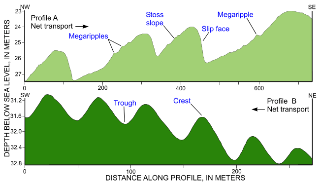
Figure 34. Bathymetric profiles across sand waves and megaripples from the combined National Oceanic and Atmospheric Administration surveys in Block Island Sound from the eastern (profile A) and western (profile B) entrances to the passage north of Block Island. Bedform asymmetry indicates net sediment is out of the passage. Locations of profiles A and B are shown in figure 18. |
||

![]() U.S. Department of the Interior |
U.S. Geological Survey
U.S. Department of the Interior |
U.S. Geological Survey
URL: http://pubsdata.usgs.gov/pubs/of/2012/1005/html/fig34.html
Page Contact Information: GS Pubs Web Contact
Page Last Modified: Tuesday, 22-Jul-2014 11:19:15 EDT

