Skip past header information
USGS - science for a changing world
NOAA Logo with link to NOAA Home Page.CT DEEP Logo with link to CT DEEP Home Page.  

U.S. Geological Survey Open-File Report 2012–1103

Sea-Floor Character and Geology Off the Entrance to the Connecticut River, Northeastern Long Island Sound


Skip past contents information

Title | List of Figures | Conversion Factors | Abstract | Introduction | Setting | Methods | Bathymetry | Sidescan Sonar | Sediment Distribution | Bottom Photography | GIS Data Catalog | Summary | Acknowledgments | References | Contacts


Figure 11. An image of original and interpolated bathymetry from the study area.

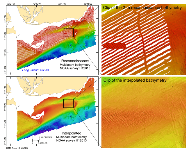
Figure 11. Comparison of the original reconnaissance multibeam bathymetry (above) and the interpolated and regridded bathymetry (below) for National Oceanic and Atmospheric Administration survey H12013. Panels on the left show the entire study area, open black polygons show locations of clips; panels on the right show clips of the enlarged bathymetry.

Skip USGS links group

Accessibility FOIA Privacy Policies and Notices

Take Pride in America logo USAGov logo U.S. Department of the Interior | U.S. Geological Survey
End of USGS links group