U.S. Geological Survey Open-File Report 2012–1103
Sea-Floor Character and Geology Off the Entrance to the Connecticut River, Northeastern Long Island Sound
 |
||
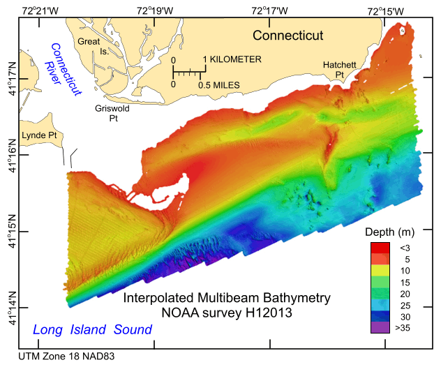
Figure 19. Digital terrain model of the sea floor produced from the multibeam bathymetry collected during National Oceanic and Atmospheric Administration survey H12013, gridded to 2 m and merged with the interpolated bathymetry data to give a more continuous perspective. Image is sun-illuminated from the northeast and vertically exaggerated fivefold. Warmer colors are shallower areas; cooler colors are deeper areas. |
||


