U.S. Geological Survey Open-File Report 2012–1103
Sea-Floor Character and Geology Off the Entrance to the Connecticut River, Northeastern Long Island Sound
 |
||
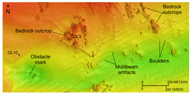
Figure 22. Detailed planar view of the multibeam bathymetric data from National Oceanic and Atmospheric Administration survey H12013 off Hatchett Point. Image shows bedrock outcrops, scattered boulders, an obstacle mark indicating net westward sediment transport, and locations of stations OL3 and OL10. Location of view is shown in figure 21. |
||