U.S. Geological Survey Open-File Report 2012–1103
Sea-Floor Character and Geology Off the Entrance to the Connecticut River, Northeastern Long Island Sound
 |
||
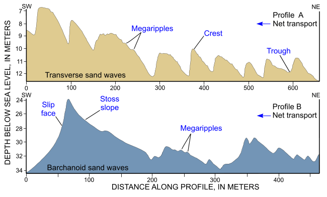
Figure 26. Cross-sectional views of sand waves produced from bathymetric data collected during National Oceanic and Atmospheric Administration survey H12013. Profile A is from the sand-wave field along the southwestern edge of the study area; profile B is from along the southern flank of Long Sand Shoal. Sand-wave asymmetry indicates southwestward net sediment transport; the presence of megaripples on stoss slopes suggests transport is active. Locations of profiles are shown in figure 21. |
||


