U.S. Geological Survey Open-File Report 2012–1103
Sea-Floor Character and Geology Off the Entrance to the Connecticut River, Northeastern Long Island Sound
 |
||
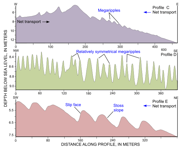
Figure 29. Cross-sectional views of sand waves produced from bathymetric data collected during National Oceanic and Atmospheric Administration survey H12013. Profile C shows that up-flank transport at the eastern end of Long Sand Shoal helps maintain the shoal; profile D shows that bedforms in the field of megaripples north of Long Sand Shoal are commonly symmetrical; and profile E shows that bedform asymmetry on the northern edge of the broad shoal west of Hatchett Reef indicates net southwestward transport. Locations of profiles are shown in figure 21. |
||


