Skip past header information
USGS - science for a changing world
NOAA Logo with link to NOAA Home Page.CT DEEP Logo with link to CT DEEP Home Page.  

U.S. Geological Survey Open-File Report 2012–1103

Sea-Floor Character and Geology Off the Entrance to the Connecticut River, Northeastern Long Island Sound


Skip past contents information

Title | List of Figures | Conversion Factors | Abstract | Introduction | Setting | Methods | Bathymetry | Sidescan Sonar | Sediment Distribution | Bottom Photography | GIS Data Catalog | Summary | Acknowledgments | References | Contacts


Figure 3. Image of a satellite view of the Connecticut River discharging into Long Island Sound after Hurricane Irene.

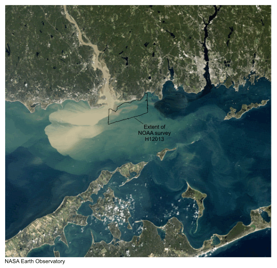
Figure 3. True-color image taken by the National Aeronautics and Space Administration (NASA) Thematic Mapper on the Landsat 5 satellite. Image shows plume of suspended sediment discharged by the Connecticut River into Long Island Sound after Hurricane Irene impacted New England during August 2011. Open polygon shows approximate location of study area.

Skip USGS links group

Accessibility FOIA Privacy Policies and Notices

Take Pride in America logo USAGov logo U.S. Department of the Interior | U.S. Geological Survey
End of USGS links group