Skip past header information
USGS - science for a changing world
NOAA Logo with link to NOAA Home Page.CT DEEP Logo with link to CT DEEP Home Page.  

U.S. Geological Survey Open-File Report 2012–1103

Sea-Floor Character and Geology Off the Entrance to the Connecticut River, Northeastern Long Island Sound


Skip past contents information

Title | List of Figures | Conversion Factors | Abstract | Introduction | Setting | Methods | Bathymetry | Sidescan Sonar | Sediment Distribution | Bottom Photography | GIS Data Catalog | Summary | Acknowledgments | References | Contacts


Figure 36. Map of sedimentary environments in the study area.

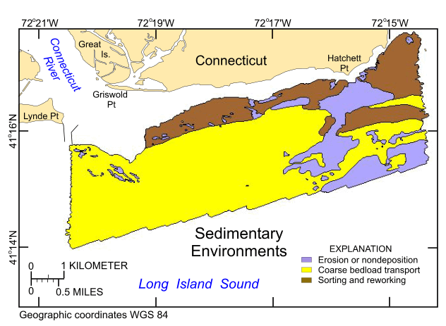
Figure 36. Distribution of sedimentary environments based on the digital terrain model from National Oceanic and Atmospheric Administration survey H12013 and verification data from U.S. Geological Survey cruises 2009-059-FA and 2010-015-FA. Areas characterized by erosion or nondeposition, coarse bedload transport, and sorting and reworking are shown.

Skip USGS links group

Accessibility FOIA Privacy Policies and Notices

Take Pride in America logo USAGov logo U.S. Department of the Interior | U.S. Geological Survey
End of USGS links group