Skip past header information
USGS - science for a changing world
NOAA Logo with link to NOAA Home Page.CT DEEP Logo with link to CT DEEP Home Page.  

U.S. Geological Survey Open-File Report 2012–1103

Sea-Floor Character and Geology Off the Entrance to the Connecticut River, Northeastern Long Island Sound


Skip past contents information

Title | List of Figures | Conversion Factors | Abstract | Introduction | Setting | Methods | Bathymetry | Sidescan Sonar | Sediment Distribution | Bottom Photography | GIS Data Catalog | Summary | Acknowledgments | References | Contacts


Figure 37. Photographs of boulders covered by sessile fauna and flora in the study area.

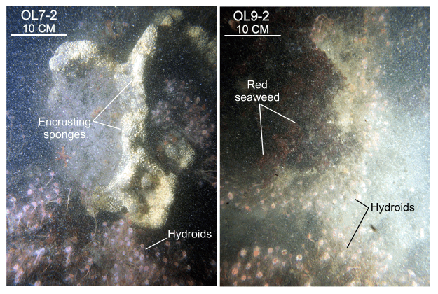
Figure 37. Hydroids, sponges, and red seaweed covering boulders at stations OL7 and OL9. Sessile fauna and flora commonly cover rocky areas of the sea floor in high-energy environments. Numbers shown next to station numbers are the image number as listed in the GIS Data Catalog section of this report. Station locations are shown in figure 15.

Skip USGS links group

Accessibility FOIA Privacy Policies and Notices

Take Pride in America logo USAGov logo U.S. Department of the Interior | U.S. Geological Survey
End of USGS links group