Skip past header information
USGS - science for a changing world
NOAA Logo with link to NOAA Home Page.CT DEEP Logo with link to CT DEEP Home Page.  

U.S. Geological Survey Open-File Report 2012–1103

Sea-Floor Character and Geology Off the Entrance to the Connecticut River, Northeastern Long Island Sound


Skip past contents information

Title | List of Figures | Conversion Factors | Abstract | Introduction | Setting | Methods | Bathymetry | Sidescan Sonar | Sediment Distribution | Bottom Photography | GIS Data Catalog | Summary | Acknowledgments | References | Contacts


Figure 40. Two photographs of the flat to faintly rippled sea floor in the study area.

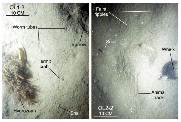
Figure 40. Bottom photographs from stations OL1 and OL2 of the relatively flat- to faintly-rippled sea floor that is prevalent in areas with lower energy sedimentary environments characterized by processes associated with sorting and reworking. Numbers shown next to station numbers are the image number as listed in the GIS Data Catalog section of this report. Station locations are shown in figure 15.

Skip USGS links group

Accessibility FOIA Privacy Policies and Notices

Take Pride in America logo USAGov logo U.S. Department of the Interior | U.S. Geological Survey
End of USGS links group