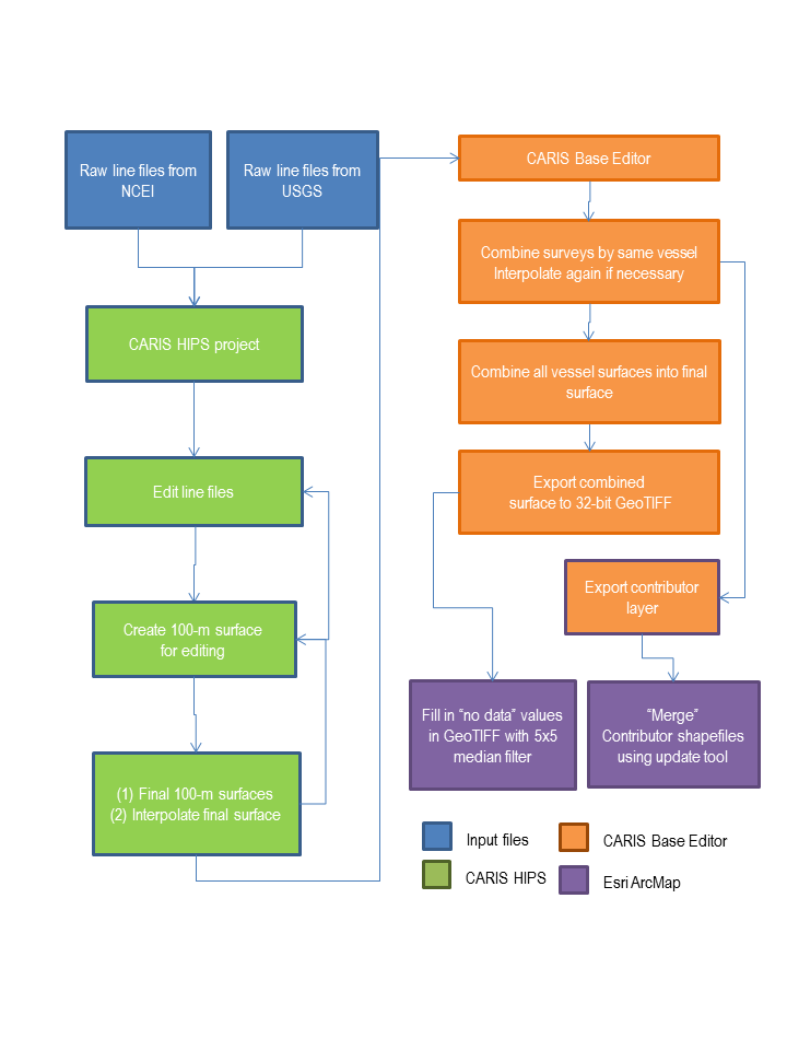
Figure 2. Generalized flow diagram showing the methods used to process raw multibeam files into final data products published in this report. CARIS HIPS, CARIS Hydrographic Information Processing System; GeoTIFF, georeferenced tagged image file format; m, meters; NCEI, National Oceanic and Atmospheric Administration National Centers for Environmental Information; USGS, U.S. Geological Survey.
Download the full size image in PDF format.
To view files in PDF format, download a free copy of Adobe Reader.
|
