Open-File Report 2013-1020
High-Resolution Geophysical Data Collected Aboard the U.S. Geological Survey Research Vessel Rafael to Supplement Existing Datasets From Buzzards Bay and Vineyard Sound, Massachusetts
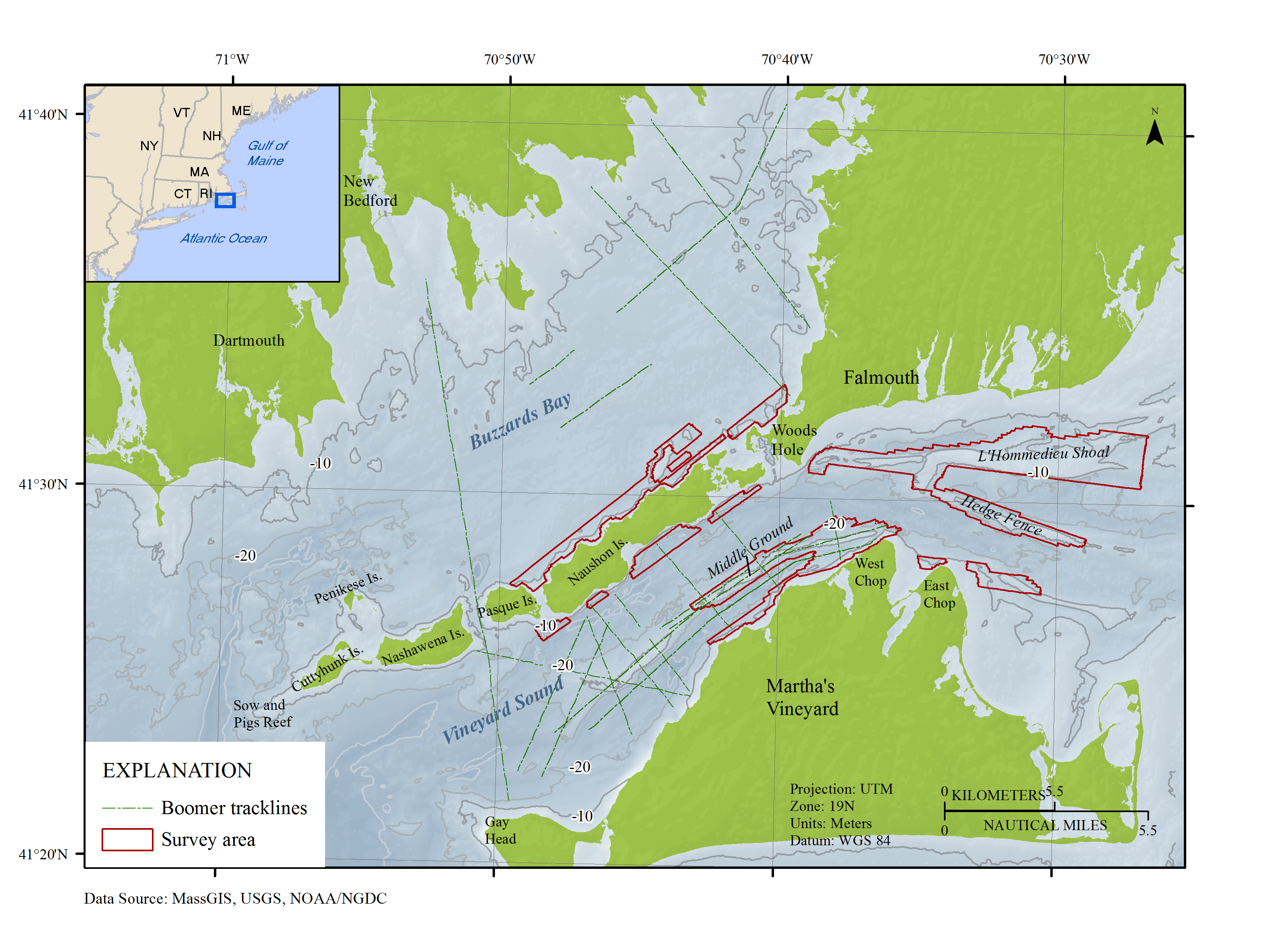
Figure 1. Location map of the bathymetric survey areas (2011-013-FA, 2007-039-FA, and 2009-068-FA) around the eastern Elizabeth Islands and Martha's Vineyard, Massachusetts (outlined in red), with Boomer tracklines from surveys 2010-100-FA and 2010-047-FA shown as dashed lines in Vineyard Sound and Buzzards Bay. Is., Island.


![]() U.S. Department of the Interior |
U.S. Geological Survey
U.S. Department of the Interior |
U.S. Geological Survey
URL: http://pubsdata.usgs.gov/pubs/of/2013/1020/html/imagepages/ofr2013-1020_Figure1.html
Page Contact Information: GS Pubs Web Contact
Page Last Modified: Wednesday, 12-Mar-2014 17:24:34 EDT
