|
This appendix describes the data collected for this project, the location of the data, and how to access the data.
Data Format and Projection
All vector data are delivered as Esri shapefiles in the geographic coordinate system (WGS 84). The raster data are in GeoTIFF and Esri grid formats in Universal Transverse Mercator (UTM), Zone 19N, WGS 84 projection. These data can also be accessed through the U.S. Geological Survey Coastal and Marine Geology Program Web Map server (http://coastalmap.marine.usgs.gov/).
All spatial data are distributed with Federal Geographic Data Committee (FGDC) compliant metadata in 4 formats—extensible markup language (XML), text (TXT), hypertext markup language (HTML), and frequently asked questions html (FAQ). Esri ArcCatalog 9.x can also be used to examine the metadata in a variety of additional formats.
Data Access
The complete datasets from this project can be accessed in the following ways, depending on available software:
- With ArcGIS 9.2 or later, all shapefile and raster data may be viewed and manipulated, although the Spatial Analyst extension will be required to fully examine and work with the Esri grids. Download the GIS_catalog.zip file (585 megabytes) to a computer and open the ArcMap document 2013_1020.mxd. This map document has all the data layers loaded in the table of contents and uses relative links.
- Without any geographic information system (GIS) software, view the data through ArcReader, a free mapping application distributed by Esri for Windows, Linux, and Unix operating systems. Download ArcReader from the Esri Web site (http://www.esri.com/software/arcgis/arcreader/download.html) and follow the directions for downloading and installing the free software. Once ArcReader is installed, all the data can be viewed by opening the published map file (PMF) named 2013_1020.pmf, which was created in ArcMap version 9.3.1.
Data Organization
The data are organized in folders on the Publications Warehouse web site. Data layers can be downloaded individually using the table below or collectively from the GIS_catalog.zip file.
 GIS_catalog GIS_catalog
The following is a listing of selected contents of the GIS_catalog.zip file:
basemap
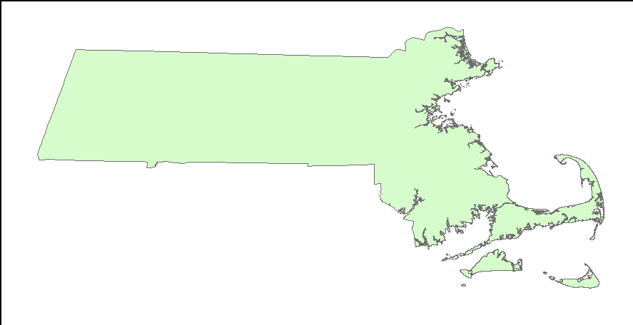
MAGIS_25K_land.shp—Outline of the Commonwealth of Massachusetts (1:25,000).
bathy
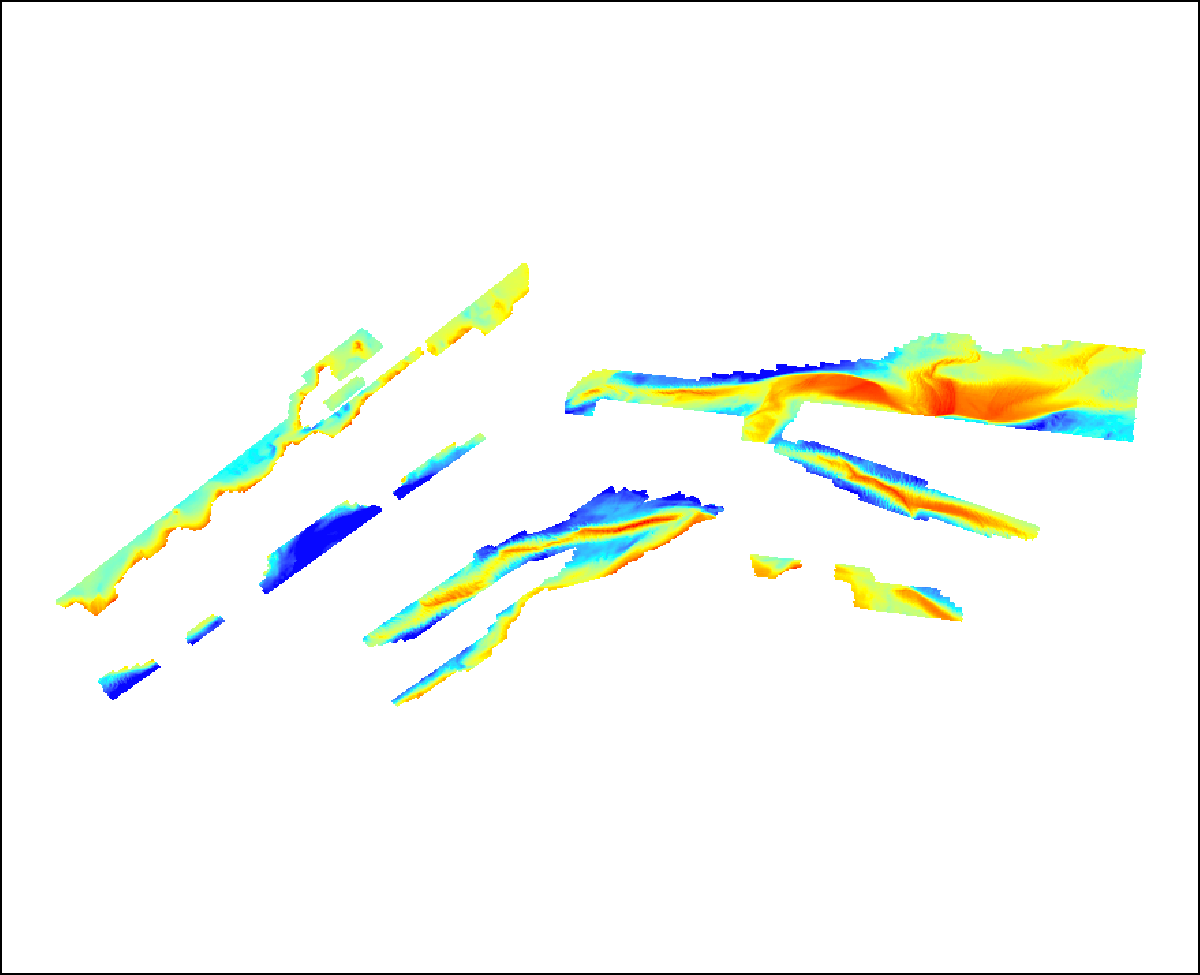
- all
- allswathi_5m—Grid: Bathymetry of all three bathymetric surveys at 5.0-meter (m) resolution. Data gaps have been filled with interpolated values.
2011-013
- fa2011013_2m—Grid: Bathymetry of survey 2011-013-FA area at 2.0-m resolution. Data gaps are left as no data values.
- mg
- mg-2m—Grid: Bathymetry for middle ground surveys at 2.0-meter resolution. Data gaps are left as no data values.
- ALL_contour5m_dd.shp—Shapefile: Bathymetric contours at 5-m interval.
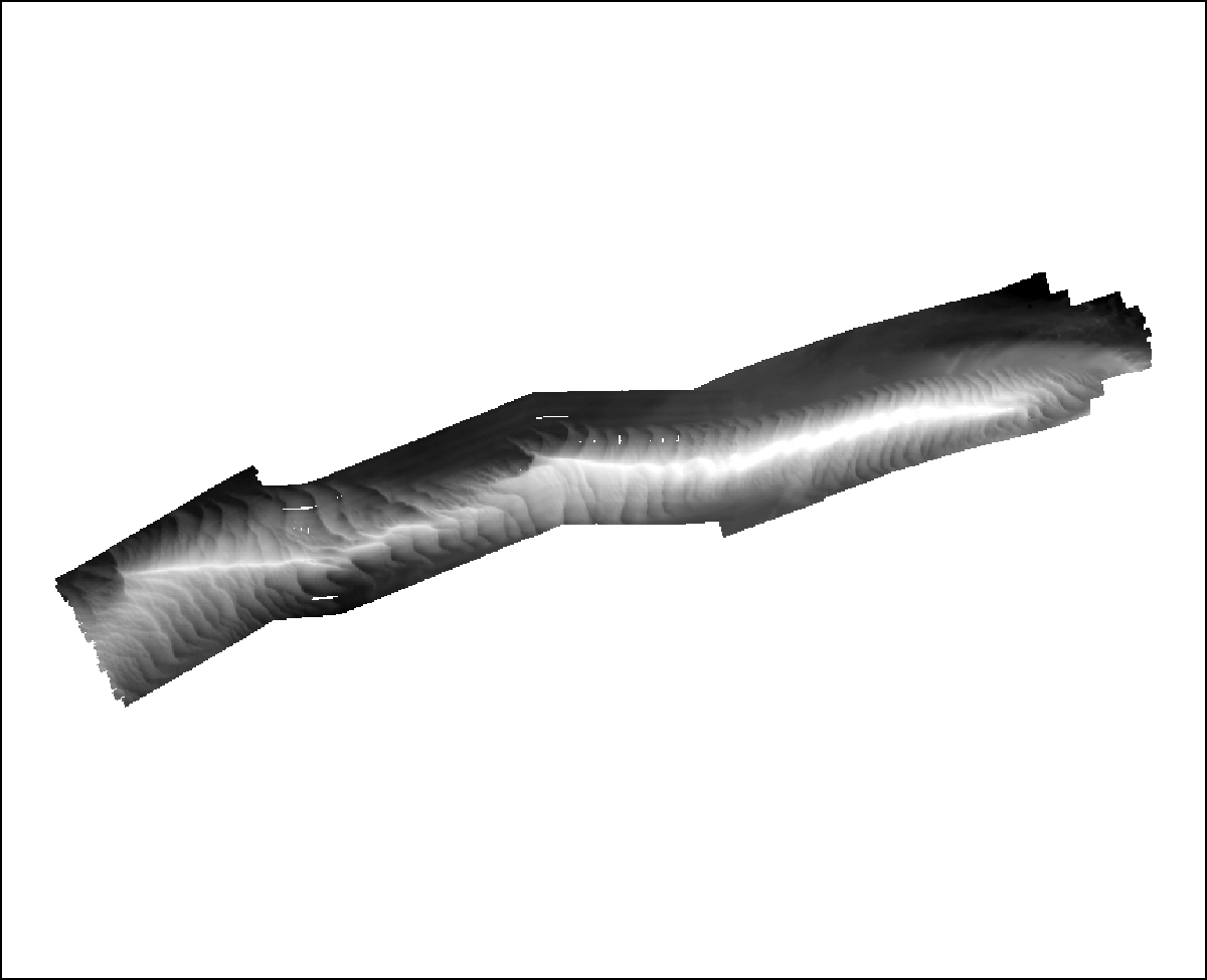
- allsswathi_hs.tif—Image: Hillshade relief image at 5.0-m resolution of all three swath surveys.
- fa2011013_hs.tif—Image: Hillshade relief image at 2.0-m resolution of survey 2011–013–FA.
- mg-hs.tif—Image: Hillshade relief image at 2.0-m resolution.
hypack
- 2007-039-FA—Raw HYPACK navigation for survey 2007–039–FA in text format.
- 2009-068-FA—Raw HYPACK navigation for survey 2009–068–FA in text format.
- 2010-047-FA—Raw HYPACK navigation for survey 2010–047–FA in text format.
- 2010-100-FA—Raw HYPACK navigation for survey 2010–100–FA in text format.
- 2011-013-FA—Raw HYPACK navigation for survey 2011–013–FA in text format.
seisimage
- boomer:
- 2010-047-FA—This folder contains Portable Network Graphics (PNG) format images of seismic-reflection profiles from survey 2010–047–FA.
- 2010-100-FA—This folder contains PNG images of seismic-reflection profiles from survey 2010–100–FA.
- knudsen:
- Knudsen: 2011-013-FA—This folder contains PNG images of seismic-reflection profiles from survey 2011–013–FA.
These images can be hyperlinked to the seismic trackline file within the ArcMap™ map document 2013-1020.mxd. To hyperlink to the seismic images, the seismic tracklines must be selected within the Table of Contents, and the Hyperlink base within the Document Properties must be specified.
sidescan
- Klein
- Klein_2011-013_1m.tif—GeoTIFF: Sidescan mosaic image at 1.0-m resolution.
- Swath
- Swath_1m.tif—GeoTIFF: Backscatter mosaic image at 1.0-m resolution.
svps
- noheader—Raw sound velocity data files in CSV (comma-separated value) format
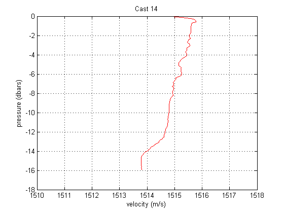
- svp_images—PNG (picture nework graphic): Images of sound velocity profiles for surveys 2011-013-FA, 2009-068-FA, and 2007-039-FA.
- SVPprofile_locs.shp—Shapefile: sound velocity profile locations for surveys 2011–013–FA, 2009–068–FA, and 2007–039–FA.
tracklines
- 2010-047-FA_Boomer_cdp500.shp – Shapefile: Boomer shot points at 500-shot interval from survey 2010–047–FA.
- 2010-047-FA_Boomer_tracklines.shp – Shapefile: Boomer tracklines from survey 2010–047–FA.
- 2010-100-FA_Boomer_cdp500.shp – Shapefile: Boomer shot points at 500-shot interval from survey 2010–100–FA.
- 2010-100-FA_Boomer_tracklines.shp – Shapefile: Boomer tracklines from survey 2010–100–FA.
- 2011-013-FA_Klein3k_tracklines.shp – Shapefile: Klein 3000 sidescan-sonar tracklines from survey 2011–013–FA.
- 2011-013-FA_Knudsen_500sht.shp – Shapefile: Knudsen shot points at 500-shot interval from survey 2011–013–FA.
- 2011-013-FA_Knudsen_tracklines.shp – Shapefile: Knudsen tracklines from survey 2011–013–FA.
- All_Swath_tracklines.shp – Shapefile: Swath interferometric tracklines from surveys 2011–013–FA, 2009–068–FA, and 2007–039–FA.
Map documents:
2013_1020.mxd.—ArcGIS 9.3.1 map document with all data loaded in the ArcMap table of contents.
2013_1020.pmf.—Esri ArcReader (created with Esri ArcGIS Publisher 9.3.1) map document for use with free ArcReader software. Download ArcReader at http://www.esri.com/software/arcgis/arcreader/download.html.
Data Preview
To download raster and vector data, right click on the link within the “Download file” column in the table below. Select “Save Target As...” to save a compressed ZIP file to the local hard drive.
Raster Data—The primary coordinate system for the raster data is WGS 84 UTM Zone 19. The link in the “Download file” column provides access to a compressed ZIP file, which contains the raster data.
Raster layer (metadata) |
Description |
Preview |
Download file
(size) |
| fa2011013_2m |
2-m bathymetric grid in Esri 32-bit continuous floating point format for survey 2011-013-FA |

|
Grid
(13 MB) |
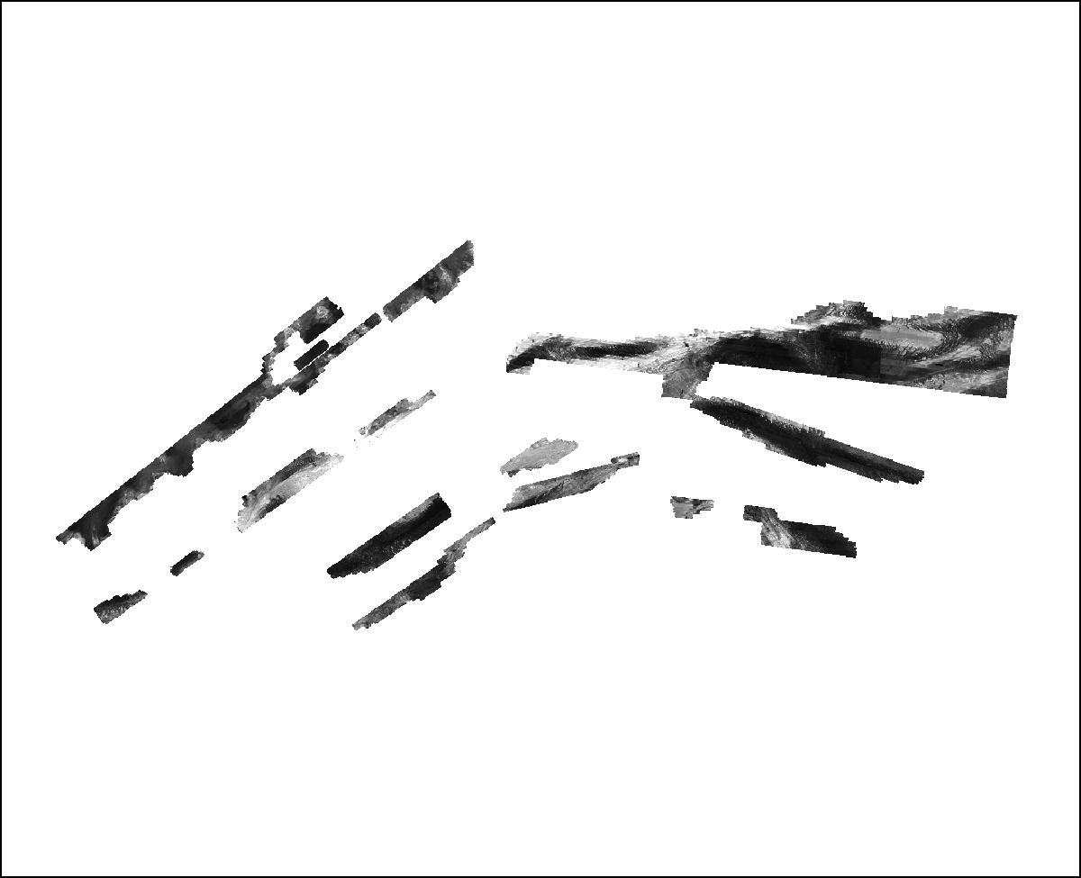
| all_swathi_5m |
5-m bathymetric grid in Esri 32-bit continuous floating point format for all three interferometric surveys |

|
Grid
(11 MB) |
| mg_2m |
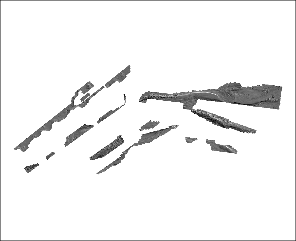
2-m bathymetric grid in Esri 32-bit continuous floating point format for survey 2009-068-FA and 2007-039-FA |

|
Grid
(2 MB) |
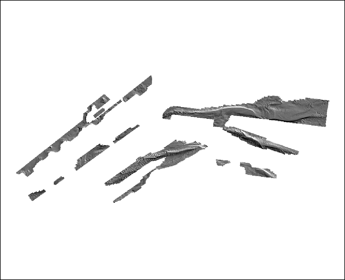
| fa2011013_hs |
2-m bathymetric hillshaded relief image in 8-bit continuous unsigned integer GeoTIFF format for survey 2011-013-FA |

|
GeoTIFF
(14 MB) |
| all_swathi_hs |
5-m bathymetric hillshaded relief image in 8-bit continuous unsigned integer GeoTIFF format for all three interferometric surveys |

|
GeoTIFF
(2.1 MB) |
| mg_hs |
2-m bathymetric hillshaded relief image in 8-bit continuous unsigned integer GeoTIFF format for survey 2009-068-FA and 2007-039-FA |
|
GeoTIFF
(1.4 MB) |
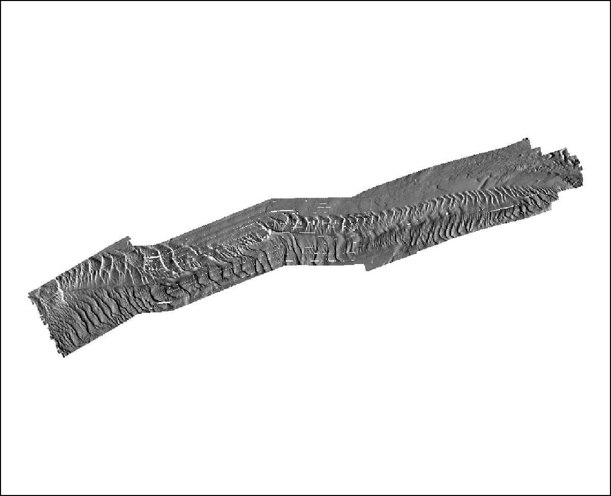
| Klein_2011-013_1m |
1-m backscatter mosaic of sidescan-sonar data in 8-bit continuous unsigned integer GeoTIFF format for survey 2011-013-FA |
 |
GeoTIFF
(54 MB) |
Swath_1m |
1-m backscatter mosaic of sidescan-sonar data in 8-bit continuous unsigned integer GeoTIFF format for all 3 interferometric surveys |

|
GeoTIFF
(6.7 MB) |
Image Data—The link in the “Download file” column provides access to a compressed ZIP file, which contains PNG-format images.
Navigation Data—The link in the “Download file” column provides access to a compressed ZIP file, which contains the navigation files.
|