Open-File Report 2013-1020
High-Resolution Geophysical Data Collected Aboard the U.S. Geological Survey Research Vessel Rafael to Supplement Existing Datasets From Buzzards Bay and Vineyard Sound, Massachusetts
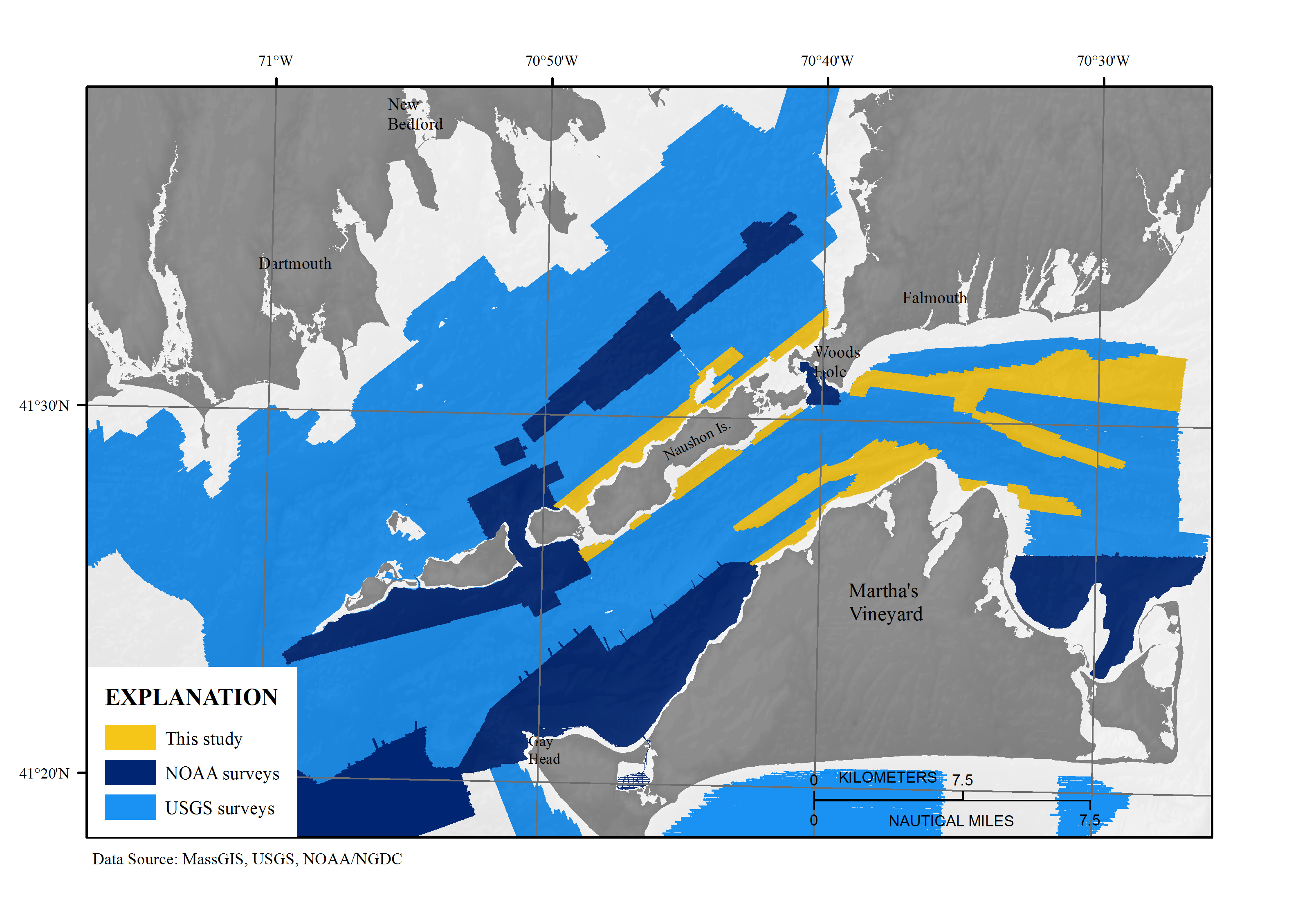
Figure 2. Bathymetric survey areas (2011-013-FA, 2007-039-FA, and 2009-068-FA) published in this report are shown in yellow along with other U.S. Geological Surveys (USGS) and National Oceanic and Atmospheric Administration (NOAA) surveys in Buzzards Bay and Vineyard Sound. This small boat survey was completed to fill gaps in the shallow water areas around the eastern Elizabeth Islands and Martha's Vineyard, Massachusetts. Is., Island. See the ‘additional sample and geophysical data’ section under ‘Data Collection and Processing’ for more information regarding the other USGS and NOAA surveys shown in this map.


![]() U.S. Department of the Interior |
U.S. Geological Survey
U.S. Department of the Interior |
U.S. Geological Survey
URL: http://pubsdata.usgs.gov/pubs/of/2013/1020/html/imagepages/ofr2013-1020_Figure2.html
Page Contact Information: GS Pubs Web Contact
Page Last Modified: Wednesday, 12-Mar-2014 17:24:14 EDT
