Open-File Report 2014–1012
![]() Title |
List of Figures |
Conversion Factors |
Abstract |
Introduction |
Methods |
Bathymetry |
GIS Data Catalog |
Summary |
Acknowledgments |
References |
Contacts
|
Index
Title |
List of Figures |
Conversion Factors |
Abstract |
Introduction |
Methods |
Bathymetry |
GIS Data Catalog |
Summary |
Acknowledgments |
References |
Contacts
|
Index
 |
||
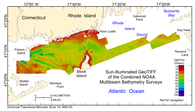
Figure 9. Digital terrain model (DTM) of the sea floor produced from the combined multibeam bathymetry collected during National Oceanic and Atmospheric Administration (NOAA) surveys H11922, H11995, H11996, H12009, H12010, H12011, H12015, H12023, H12033, H12137, H12139, H12296, H12298, and H12299 in Rhode Island and Block Island Sounds. Image is sun-illuminated from the northeast and vertically exaggerated by a factor of 5. Warmer colors denote shallower areas; cooler colors denote deeper areas. See key for depth ranges. |
||