Skip past header information
USGS - science for a changing world

Open-File Report 2014-1203


Maps Showing Bathymetry and Modern Sediment Thickness on the Inner Continental Shelf Offshore of Fire Island, New York, Pre-Hurricane Sandy


Skip past contents information/ Title Page / List of Figures / Conversion Factors / Abstract / Introduction / Geologic Setting / Methods / Acknowledgments / Data Catalog /References Cited / Index /


High-resolution chirp seismic-reflection proflie showing stratigraphic features and geometries discussed in the text, offshore of Fire Island, New York.


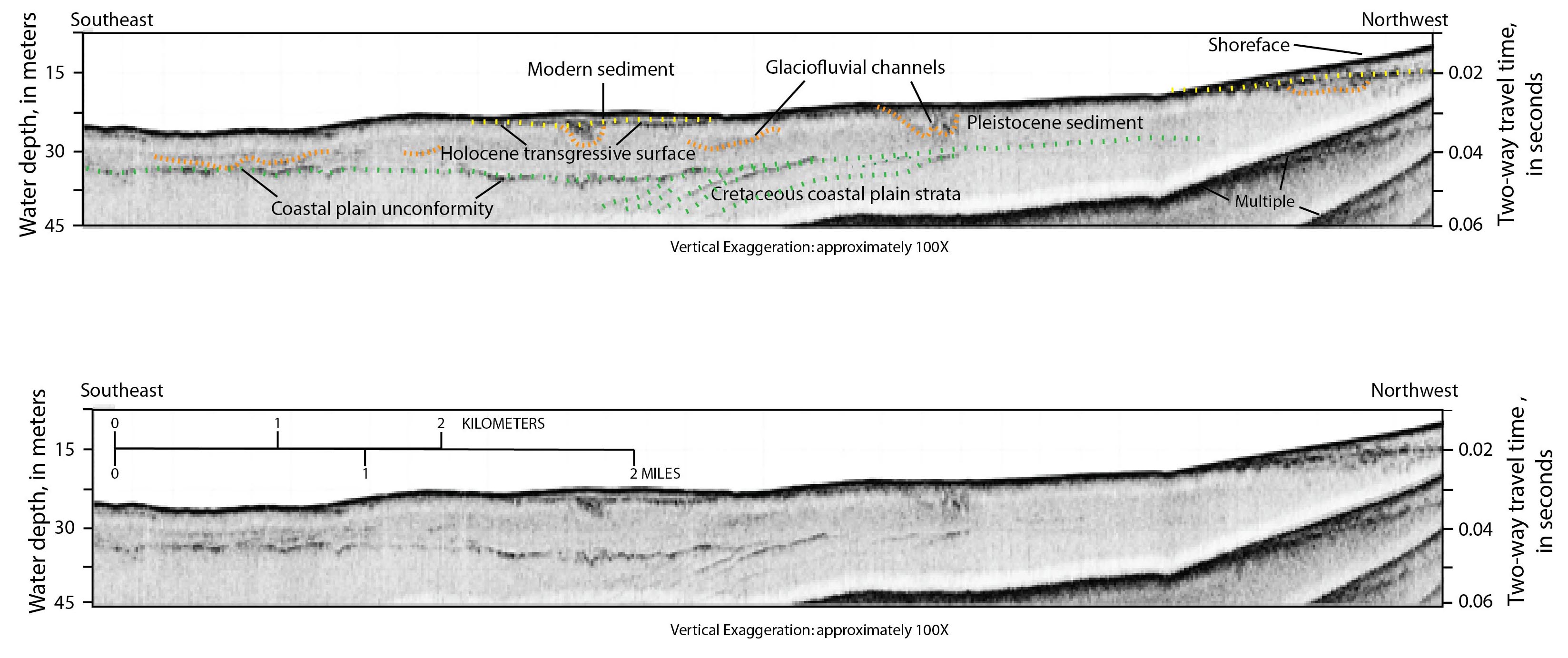
Figure 2. High-resolution chirp seismic-reflection profile illustrating stratigraphic features and geometries discussed in the text, offshore of Fire Island, New York, 2011. Location of the profile is shown in figure 1. Approximate water depth in meters is based on two-way travel time of 1,500 meters per second. A, The Holocene marine transgressive surface is marked by a yellow dotted line. Glaciofluvial channels and older Pleistocene sediments are marked by orange dotted lines, and the underlying Cretaceous-age coastal plain strata and the coastal plain unconformity are shown as green dotted lines. B, The chirp seismic-reflection profile displayed without interpretations. Figure modified from Schwab and others (2013).


Accessibility FOIA Privacy Policies and Notices

Take Pride in America logo USA.gov logo U.S. Department of the Interior | U.S. Geological Survey
URL: http://pubsdata.usgs.gov/pubs/of/2014/1203/ofr2014-1203-figure2.html
Page Contact Information: GS Pubs Web Contact
Page Last Modified: Wednesday, 07-Dec-2016 19:39:34 EST