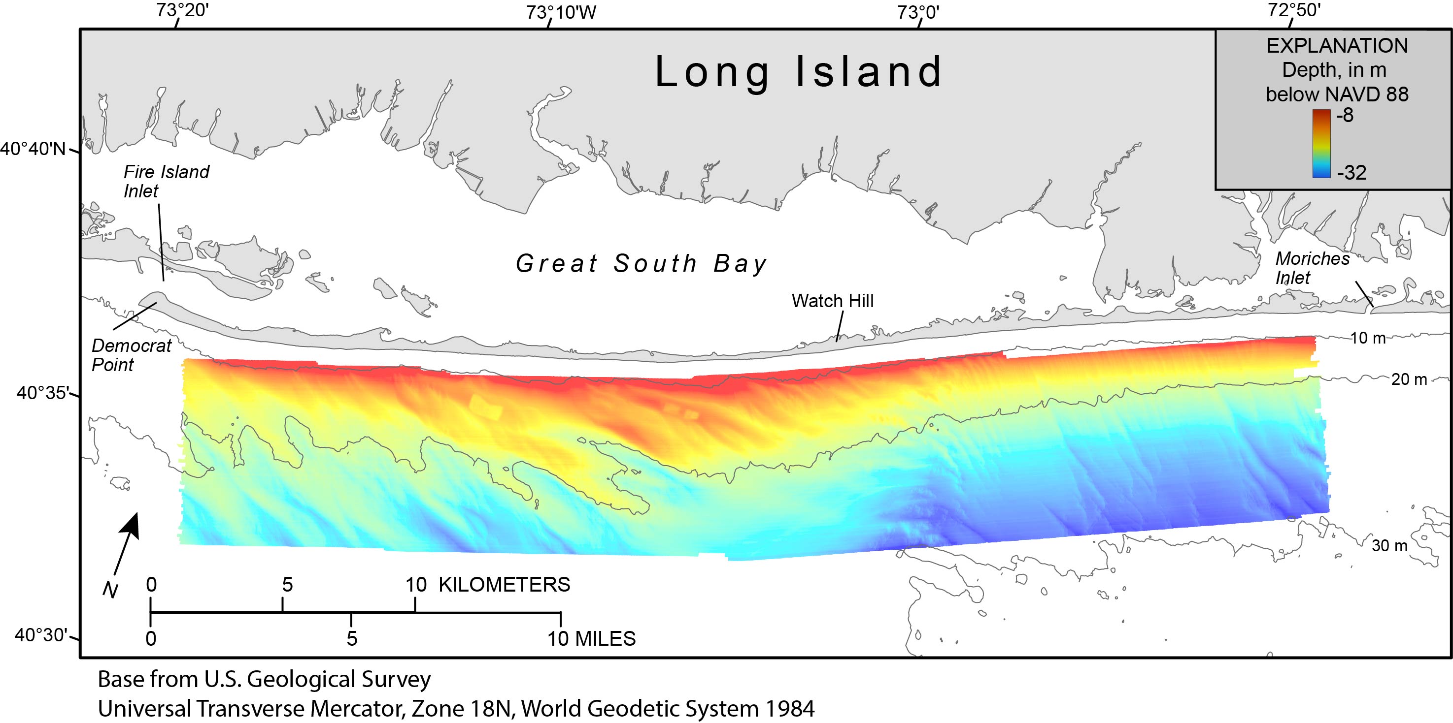
Figure 3. Map showing an interpolated bathymetric surface generated from interferometric sonar offshore of Fire Island, New York, 2011. Regional bathymetric contours are in meters (m) below the North American Vertical Datum of 1988 (NAVD 88). West of Watch Hill the modern sand deposit is organized into a series of shoreface-attached sand ridges oriented at angles oblique to the shoreline. Figure modified from Schwab and others (2013).
|
