Skip past header information
USGS - science for a changing world

Open-File Report 2014-1203


Maps Showing Bathymetry and Modern Sediment Thickness on the Inner Continental Shelf Offshore of Fire Island, New York, Pre-Hurricane Sandy


Skip past contents information/ Title Page / List of Figures / Conversion Factors / Abstract / Introduction / Geologic Setting / Methods / Data Catalog / Acknowledgments / References Cited / Index /


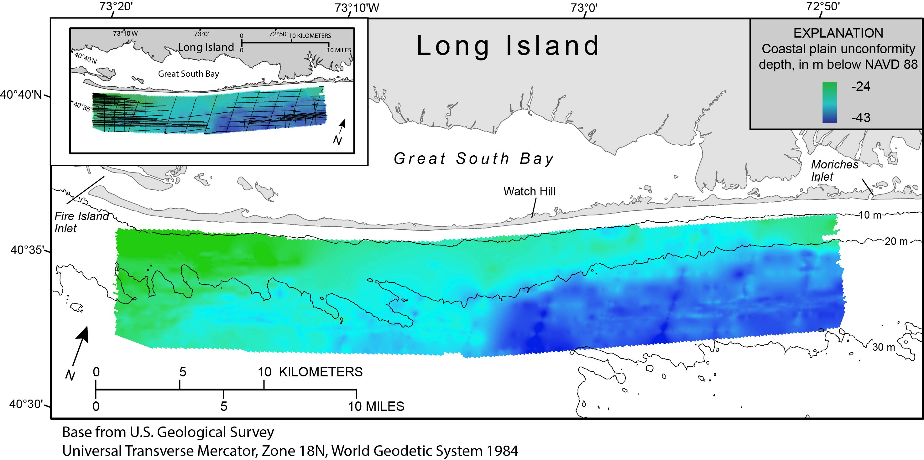
Map showing the coastal plain unconformity mapped offshore of Fire Island, New York.


Figure 7.
 Map showing the coastal plain unconformity offshore of Fire Island, New York, 2011. Regional bathymetric contours are in meters (m) below the North American Vertical Datum of 1988 (NAVD 88). The inset map shows the location of the seismic-reflection profiles where subbottom penetration and resolution allowed identification of the coastal plain unconformity. In addition to chirp profiles collected in 2011, this grid includes reprocessed boomer and sparker data collected by the U.S. Geological Survey in 1996 and 1997 (Foster and others, 1999). The relatively sparse seismic-reflection data coverage yields a generalized, regional surface, with less resolution than other maps presented.

Accessibility FOIA Privacy Policies and Notices

Take Pride in America logo USA.gov logo U.S. Department of the Interior | U.S. Geological Survey
URL: http://pubsdata.usgs.gov/pubs/of/2014/1203/ofr2014-1203-figure7.html
Page Contact Information: GS Pubs Web Contact
Page Last Modified: Wednesday, 07-Dec-2016 19:39:37 EST