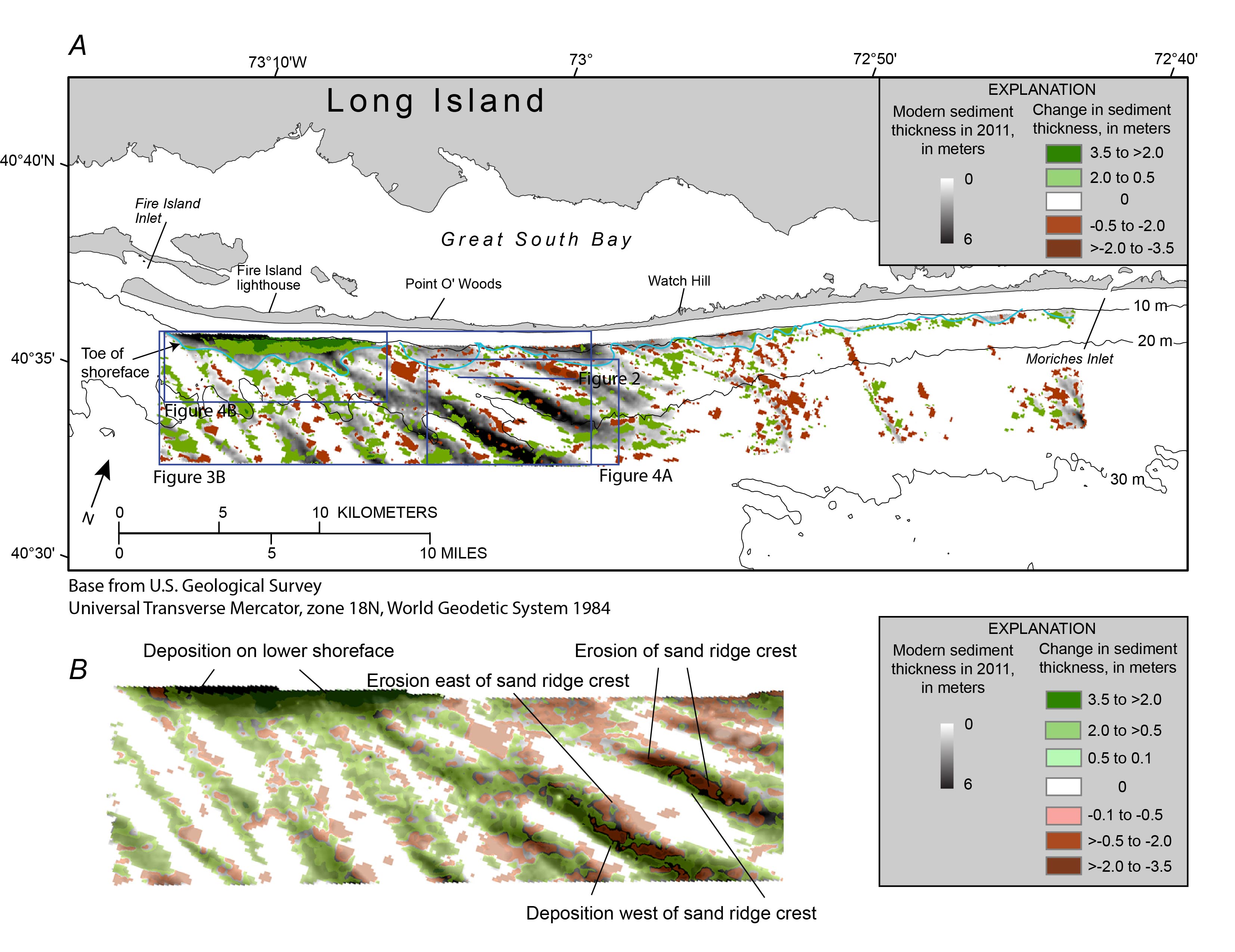
Figure 3. A, Map showing the change in modern sediment thickness greater than 0.5 meter (m) between isopachs interpreted from 1996–97 (Foster and others, 1999) and 2011 (Schwab, Denny, and Baldwin, 2014) seismic-reflection data, overlain on the 2011 modern sediment thickness isopach (Schwab, Denny, and Baldwin, 2014), offshore of Fire Island, New York. Blue line shows seaward extent (toe) of the shoreface (Schwab, Baldwin, Denny, and others, 2014). Regional bathymetric contours are in meters below the North American Vertical Datum of 1988 (NAVD 88). Figure modified from Schwab, Baldwin, Denny, and others (2014). B, Enlargement of area shown in A. Change in sediment thickness shown by using a less conservative vertical resolution limit of 10 centimeters to illustrate net westerly migration of the sand ridges, with erosion on the eastern flanks and crests of the ridges and deposition on the western flanks.
|