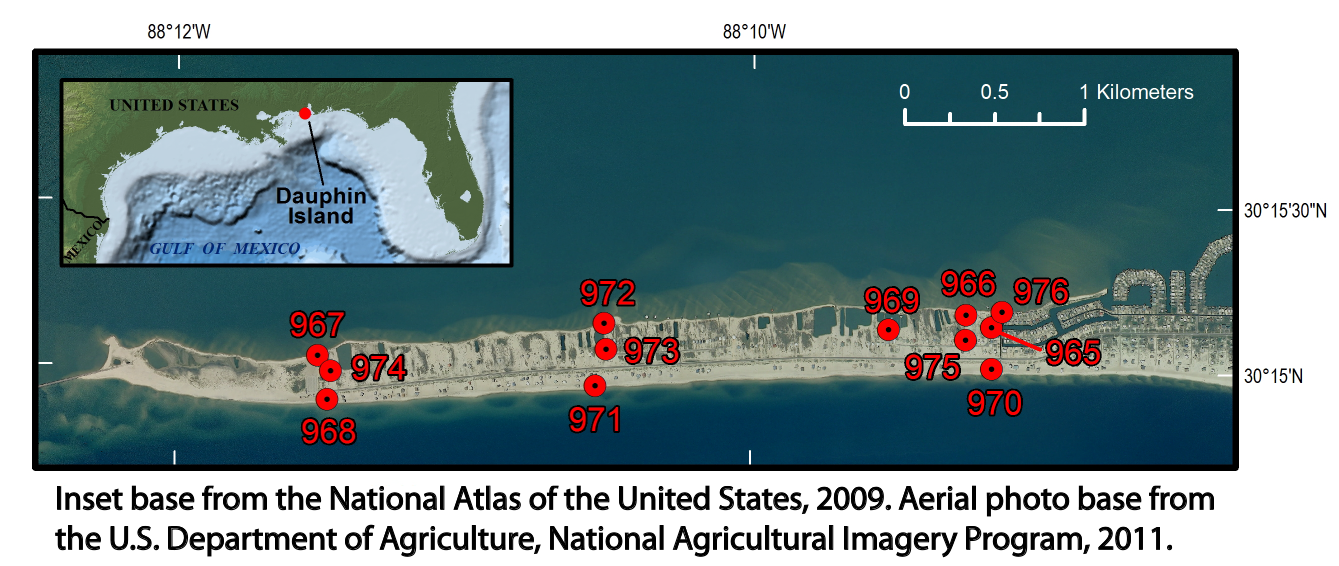
Figure 1. Locations of sites on Dauphin Island, Alabama, used to monitor water levels, atmospheric pressure, and temperatures from July 22 through November 20, 2013. Red dots on map indicate locations of sites. Inset base from the National Atlas of the United States, 2009. Aerial photo base from the U.S. Department of Agriculture, National Agricultural Imagery Program, 2011.
|
