Open-File Report 20151055
Effects of Proposed Sediment Borrow Pits on Nearshore Wave Climate and Longshore Sediment Transport Rate Along Breton Island, Louisiana
Citation"Index | List of Figures | List of Tables | Conversion Factors | Abbreviations | Abstract | Introduction | Methods | Results | Conclusions | Acknowledgments | References Cited | Appendix 1. Scenarios | Appendix 2. Example Model Input Files | Appendix 3. File Naming Conventions | Digital Data Files
 |
||
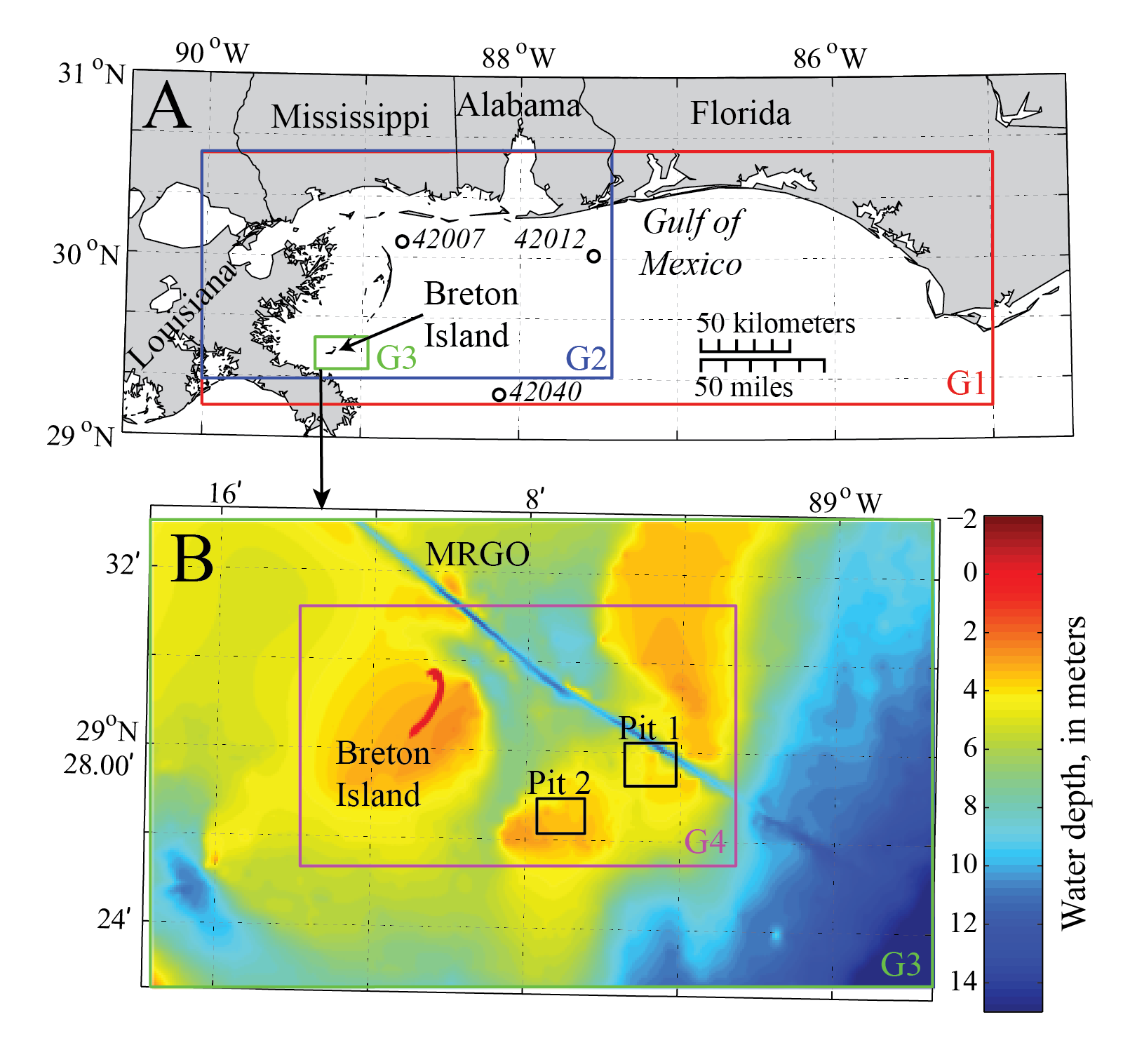
| Figure 1. Maps showing (A) the location of Breton Island in the Gulf of Mexico, the G1, G2, and G3 numerical model domains, and the three National Data Buoy Center (NDBC) buoys (42040, 42012, and 42007) used in model scenario development and assessment, and (B) the spatial extent of the G3 model domain, showing the G4 domain as well as the extent of two proposed borrow pits considered in the wave modeling study. The channel running northeast of Breton Island is the Mississippi River Gulf Outlet (MRGO). | ||

![]() U.S. Department of the Interior |
U.S. Geological Survey
U.S. Department of the Interior |
U.S. Geological Survey
URL: http://pubsdata.usgs.gov/pubs/of/2015/1055/ofr2015-1055_figure1.html
Page Contact Information: GS Pubs Web Contact
Page Last Modified: Monday, 28-Aug-2017 17:09:36 EDT
