Field Data Collection

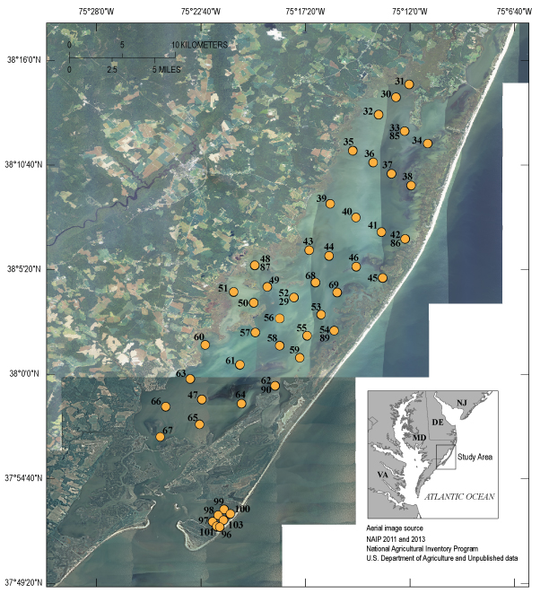
Figure 3. Aerial map showing the sample sites (numbered 29-103 with gaps) within the study areas Chincoteague Bay and Tom's Cove along the eastern shore of Maryland and Virginia. [Click to enlarge]
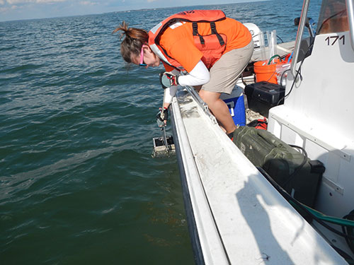
USGS SPCMSC scientists collected lagoonal bottom sediment for two areas: Chincoteague Bay, Virginia and Maryland, and Tom's Cove, Virginia, during both the spring and fall of 2014 (USGS Field Activity Number (FAN) 2014-301-FA and 2014-322-FA, respectively). Sample sites were chosen in the interest of maximizing bay coverage with approximately 10 northwest-southeast trending transects (fig. 3). In the spring (March 26–April 4, 2014), 46 surface sediment samples, six of which are field site replicates to assess site variability, were collected in Chincoteague Bay using a petite Ponar (fig. 4). Seven additional samples were collected in Tom’s Cove to the south for the purpose of comparison with the bay. In the fall (October 21–30, 2014), 44 surface samples were collected at the same site locations in Chincoteague Bay from the spring sampling trip with six field site replicates. Only two samples, both at previously sampled site locations, were collected in Tom’s Cove due to time constraints. Spring site and sample identifications were numbered 29–103 with gaps, which represent surface samples collected on land and are evaluated in a separate Open File Report. During the fall, sites were revisited and the sample identifications increased by a factor of 300 (for example, spring sample site 29G, fall sample site 329G).
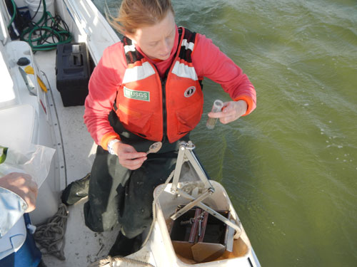
At each sample location, the top 1 cm of the recovered, undisturbed surface material from the Ponar grab was subsampled for sediment characterization (20–30 milliliters (mL) for grain-size, bulk density, water content, loss on ignition (LOI), δ13C and δ15N, and metals), micropaleontology (15–20 mL per replicate sample), and archive (10 mL) (fig. 5). Water quality parameters including salinity, pH, temperature, dissolved oxygen (DO), specific conductance, and oxidation-reduction potential (ORP), were collected at each site using a YSI Professional Plus (ysi.com) multi-sensor meter at a depth of 1 m below the water surface. Water depth was recorded at all sample locations at the time of collection with either a Garmin depth sounder or by direct measurement. No changes were made to compensate for varying tidal stages. Site coordinates were recorded on a Garmin GPSmap 76S.
The micropaleontology samples, as well as the metals, δ13C, and δ15N portions of the sediment characterization samples, were collected as part of a complementary USGS Coastal and Marine Geology Program (CMGP) Sea-level and Storm Impacts on Estuarine Environments and Shorelines (SSIEES) project study. Analyses of those data will be described in a separate report. Surface samples, sand augers, peat augers, and marsh push cores were also collected from the Delmarva coast and on Assateague Island during this field trip in the marshes and from sandy overwash deposits. Analyses of those data are described in other reports including Open–File Report 2015–1169.


