Skip past header information
USGS - science for a changing world

Open-File Report 2016–1168


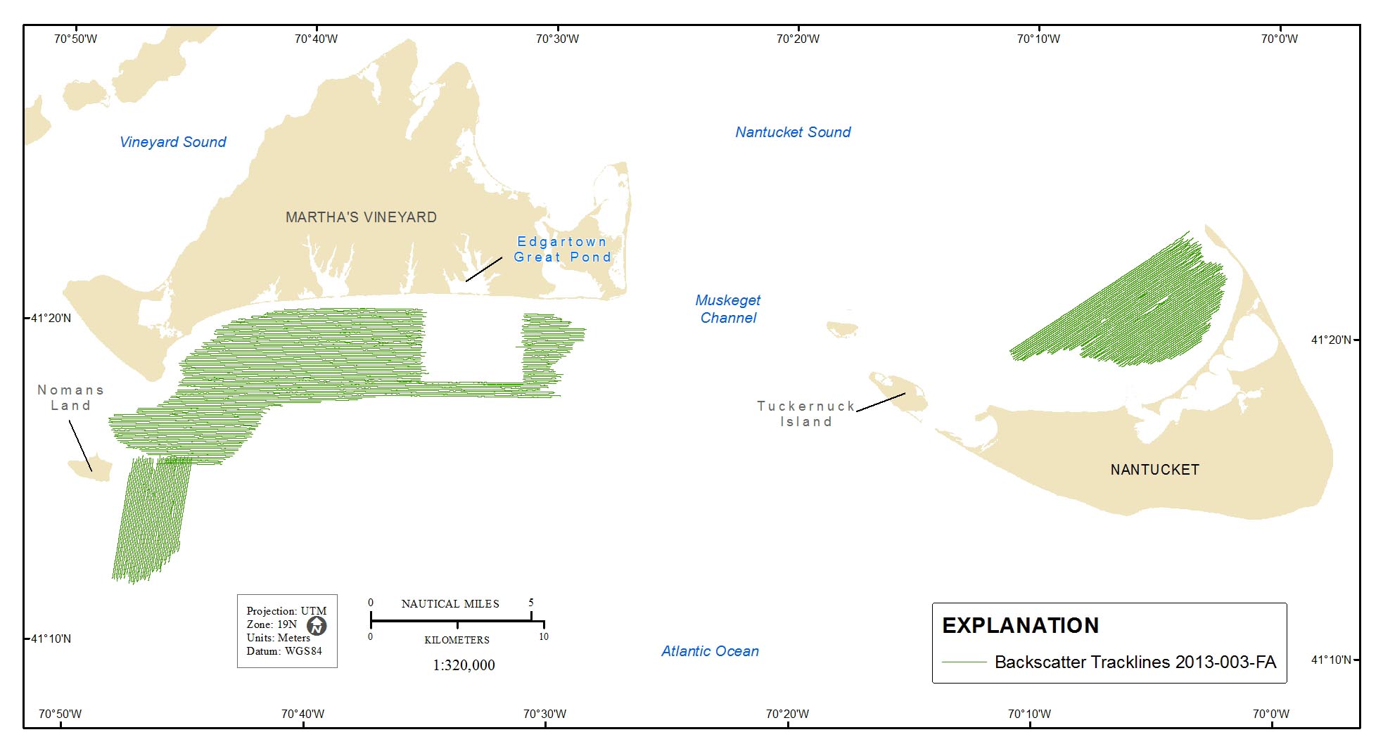
High-Resolution Geophysical Data From the Inner Continental Shelf: South of Martha’s Vineyard and North of Nantucket, Massachusetts 


Skip past contents information/ Title Page / List of Figures / Conversion Factors / Abbreviations / Abstract / Introduction / Data Collection and Processing / Acknowledgments / References Cited / Appendix 1 — Geospatial Data / Citation Page /


Map showing tracklines along which acoustic-backscatter data were collected in the survey area, south of Martha's Vineyard and north of Nantucket, Massachusetts. UTM, Universal Transverse Mercator; WGS 84, World Geodetic System of 1984.


Figure 5. Map showing tracklines along which acoustic-backscatter data were collected in the survey areas, south of Martha's Vineyard and north of Nantucket, Massachusetts. UTM, Universal Transverse Mercator; WGS 84, World Geodetic System of 1984.

Accessibility FOIA Privacy Policies and Notices

Take Pride in America logo USA.gov logo U.S. Department of the Interior | U.S. Geological Survey
URL: http://pubsdata.usgs.gov/pubs/of/2016/1168/ofr2016-1168-figure5.html
Page Contact Information: GS Pubs Web Contact
Page Last Modified: Wednesday, 07-Dec-2016 23:31:29 EST