
PRE-1980 TEPHRA-FALL DEPOSITS ERUPTED FROM MOUNT ST. HELENS, WASHINGTON
By Donal R. Mullineaux
A study of the stratigraphy, age, distribution, and characteristics of more than 100 tephra-fall deposits erupted during the past 40,000 years.
Thickness
Deposits of ash clouds and other pyroclastic flowage phenomena
Oxidized ash-rich deposits of undetermined origin
Direction and distance from Mount St. Helens
Ferromagnesian minerals
Chemical analyses
Age
Previous work
Distribution
Preservation
Location of relatively complete tephra sequences
- Composition
- Diagnostic features
- Stratigraphic relations
- Distribution and thickness
- Age
- Description of layers in Set B
Subdivisions of eruptive history
APPENDIX -- Chemical Analyses of pumice from described tephra deposits
MEASURED SECTIONSMeasured Section C-1, Road 25 site
Measured Section C-2, Muddy River quarry site
Measured Section M-1, Muddy River quarry site
Measured Section M-2
Measured Section S-1
Measured Section J-1
Measured Section Y-1
Measured Section P-1
Measured Section B-1
Measured Section B-2
Measured W-1
Measured X-1
FIGURES
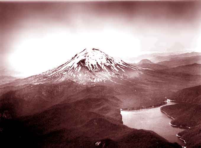
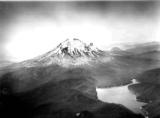
1. Photograph of Mount St. Helens from the northeast showing pre-1980 profile
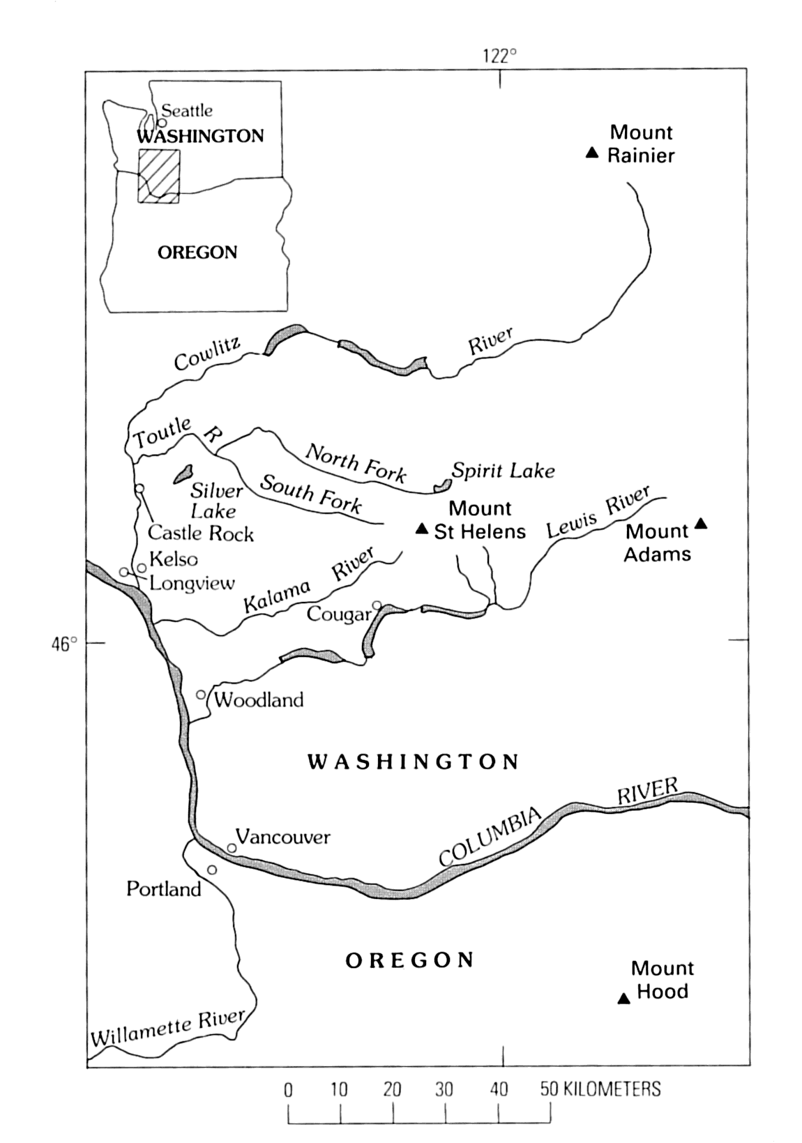
2. Map showing location of Mount St. Helens
3. Photograph of thick tephra sequence
4. Diagram showing wind directions over Mount St. Helens
5. Map showing areas below 600 m altitude near Mount St. Helens
6. Photographs showing field characteristics of tephra sets
7. Photograph of set C at Road 25 site
8. Composite columnar section of set C
9. Map showing approximate thickness of tephra in set C
10. Columnar sections of set C
11. Photograph of set C at Muddy River quarry site
12. Photograph showing typical colors in set M
13. Composite columnar section of set M
14. Map showing approximate thickness of tephra in set M
15. Columnar sections of set M
16. Photograph of upper part of set M showing layer Mt
17. Photograph of typical thin, disturbed tephras of set K
18. Map showing location and thickness of tephra in set K
19. Columnar sections of set K
20. Photograph of set S
21. Composite columnar section of set S
22. Map showing location and thickness, selected outcrops, set S
23. Columnar sections of set S
24. Photograph of set S
25. Map showing thickness of layers in set S
26. Photograph of layer Ss
27. Photograph of set J
28. Columnar sections of set J
29. Map showing thickness of tephra set J
30. Columnar sections of set J
31. Maps showing thickness of layers in set J
32. Photograph of layer Jy
33. Photograph of layer Jg
34. Photograph of set Y showing thick layer Yn
35. Photograph of set Y showing thick layer Ye
36. Composite columnar section of set Y
37. Maps showing thickness of set Y
38. Columnar sections of set Y
39. Photographs of set Y
40. Maps showing thickness of layers in set Y
41. Photograph of layer Yd
42. Photograph of upper part of set Y
43. Map showing thickness of ash bed pbp
44. Photographs of set P
45. Composite columnar section of set P
46. Map showing thickness of set P
47. Columnar sections of set P
48. Photograph of set B
49. Composite columnar section of set B
50. Thicknesses of set B
51. Columnar sections of set B
52. Maps showing thickness of layers in set B
53. Photograph of set B showing layer Bi
54. Map showing thickness of ash bed ba
55. Map of distribution and thickness of layer D
56. Photograph of set W
57. Composite columnar section of set W
58. Photograph of set W showing thick layer We
59. Map showing thickness of set W
60. Columnar sections of set W
61. Maps showing thickness of layers in set W
62. Photograph of large clasts in layer Wa
63. Photograph of clasts in layer Wb
64. Photograph of set X
65. Composite columnar section of set X
66. Map showing thickness of set X
67. Photograph of layers in set X
68. Columnar sections of set X
69. Maps showing thickness of layers in set X and of ash bed z
70. Photograph of layer T
71. Map showing distribution and thickness of layer T
72. Photograph of ash bed erupted in 1842
TABLES
1. Grain-size classification for tephra fragments
2. Radiocarbon dates pertaining to age of tephra layers at Mount St. Helens
3. Relation of principal tephra sets to eruptive stages and periods at Mount St. Helens
4. Principal tephra-fall units erupted from Mount St. Helens prior to 1980
5. Representative ferromagnesian mineral contents of layers of set B
6. Estimated relative proportions of ferromagnesian phenocrysts in layers of set X
7. Classification of pre-1980 eruptive history, Mount St. Helens
Top
| AccessibilityFOIAPrivacyPolicies and Notices | |
| |
|