
|
|
Scientific Investigations Map 2940 |
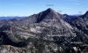
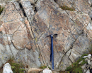
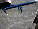
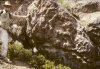
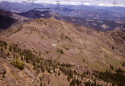
| Kps-1. Pebble conglomerate of the Virginian Ridge Formation of Barksdale (1975) in Pasayten Group of Kiessling and Mahoney (1997) (Kps) exposed north of Cady Pass [RMsw]. Weathering has reduced the matrix since the late Pleistocene Cordilleran Ice Sheet cut and polished harder chert pebbles. |

|
Other photos that show unit Kps:
      |
 |